Ohio is an amazing state to visit and explore. This is the 34th largest state by area covering approx. 116,096 kilometres square (which includes 101,156 km2 of land area and 10,040 km2 of water area). And, Ohio is also the seventh most populous state having a population of nearly 11.8 million. There are currently 247 cities, villages and towns in Ohio (including 88 Counties). So, now if you want to learn more about the cities and towns of Ohio then you must stay on this page and check our collection of maps. Please scroll down the page and let’s start with the map of Ohio with Cities.
Maps of Ohio with Cities and Towns:
1. Map of Ohio with Cities:
2. Map of Ohio with Towns:

3. Detailed Map of Ohio with Cities, Towns & Villages:

4. Ohio Map:

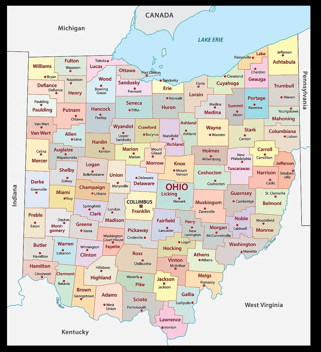
5. County Map of Ohio:
Above, we have added five types of different maps related to the cities and towns of Ohio. Below, we’re also giving some information about each map, so read the information and get any map on your device for free.
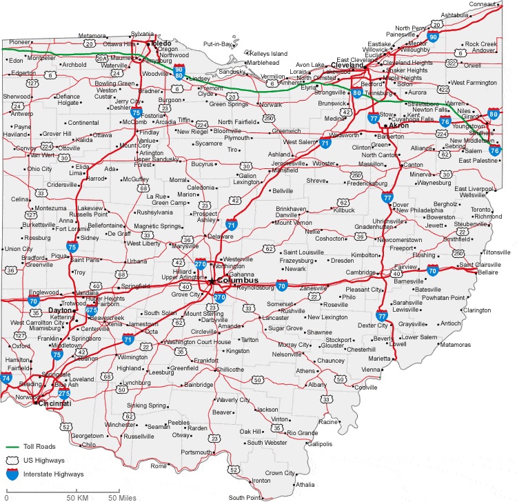
The first map is related to the cities of Ohio state. So, you can easily locate any city in Ohio with the help of this map. Now, on the next map, you will get to know about the city of Ohio. And the third map is the main and detailed map of Ohio with Cities and Towns. You will easily navigate anywhere inside any city of OH, USA on this map because roads and highways are also visible. You can also check some other Roads and Highway Maps of Ohio State if you are looking for a detailed city road and highway network map.
The fourth map is related to the complete state map of Ohio with towns, cities, roads and highways. This map is similar to the previous map, but this map shows some other places and landmarks. For example, you will see rail networks, airports, beaches, malls, rivers, lakes, etc. The fifth map is related to the main County map of Ohio. In this map, you can easily locate any county in this state. The county seat major cities are also mentioned on this map.
So, these were some best printable Town and City maps of Ohio. You can easily print any map because all maps are HD quality and available in PDF and JPG format. And you can download any map for free by clicking on the buttons under the preview image.