Nevada is a state in USA, which is located in the Western region of the country. Nevada is officially known as the Silver State and also has two nick names that are: “The Sagebrush State” and “The Battle Born State”. The capital city of Nevada is Carson City and the largest city in this state is Las Vegas. Nevada becomes the 36th state of the USA on 31st October,1864. You can explore more about this state through maps. And, here on this page we are adding some printable maps of Nevada state. So, please scroll down the page and check our collection of maps. A map of Nevada state will be very helpful for you. You can also check some other Roads and Highway Maps of Nevada (NV), if you are traveling to this state or any city of Nevada.
Nevada (NV) State Maps Collection:
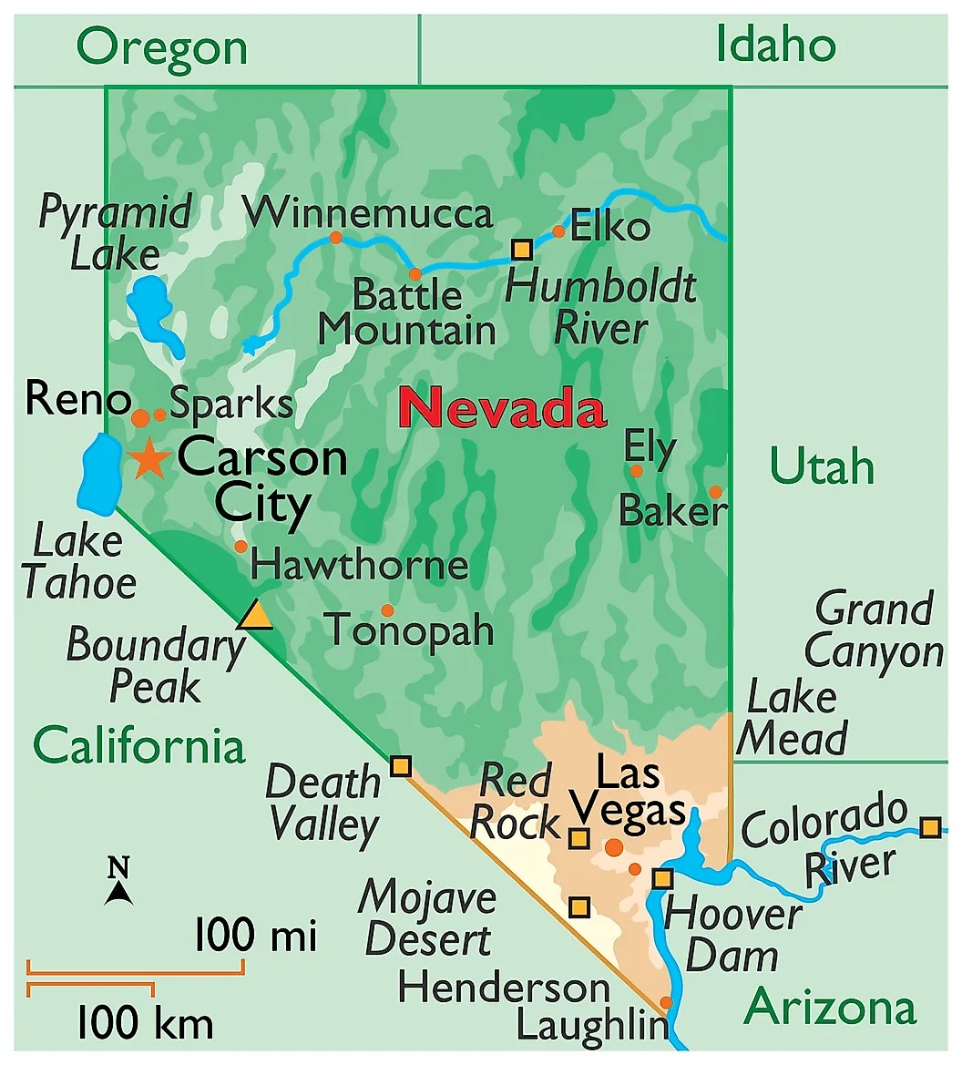
1. Map of Nevada:
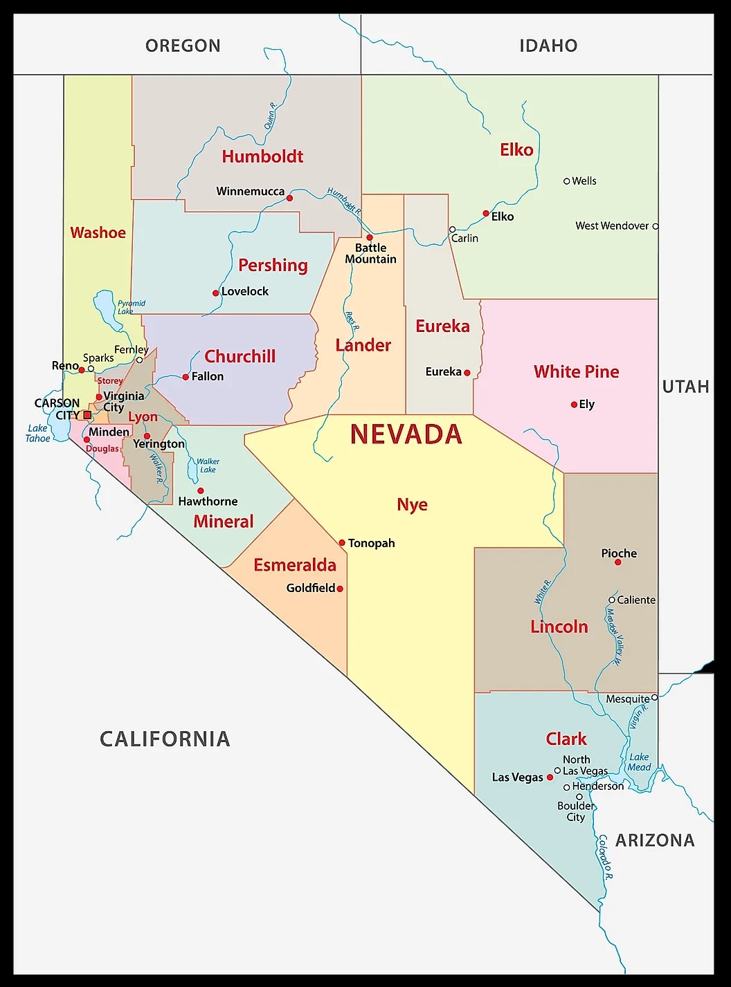
2. County Map of Nevada:
3. Printable City and Town Map of Nevada :

4. Nevada on US Map:

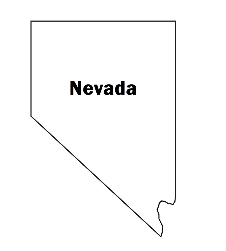
5. Outline Map of Nevada:
6. Google Map of Nevada:

7. Map of Northern Nevada:

8. Southern Nevada Map:

Here, we have added eight different types of maps. All maps belong to Nevada State. Each map contains some useful information. For you, we are adding some more useful information about each map here.
The first map is related to the main state map of Nevada, and this map shows all major cities and all counties. You can easily identify any city with the help of this map. The second map is related to the county map of NV state. It is a printable and large Nevada county map. This County map also shows all county seats of this state.
The third map shows the Cities and Towns of NV state. In this map, you can see all major cities and towns and county names. The next map shows the location of Nevada state on the USA Map. As you can see in the map, the area filled with red colour indicates this state. The next map is also a location map that shows Nevada’s location on a global or world map.
The sixth map is a simple outline or blank map of the Nevada state which shows the outer boundary of this state. The seventh map is a Satellite map of this state which shows the Satellite image and structure of this state. You will only see the boundaries on this map. So, if you want a detailed map of this state, please check the first map. A thin yellow line indicated its boundary.
The eighth map is titled “Google Map of Nevada.” This map is a type of Google map or Google Earth Map of this state that shows some major cities, towns, and capital city. The ninth map is a specific region map of this state, which is the Southern Nevada Map. In this map, you will get to know all Southern area cities, towns, and roads. And, the last map is a map of Northern Nevada that shows all towns, cities and other places of Nevada. These were some best and most useful Nevada Map that we have added above. All the maps are available in PDF and JPG (Image) formats. You can easily download any map by clicking on the buttons under the preview image. All these maps are free to download