Montana is located in the Western USA of the area of West Mountain Subregion. This state is the fourth largest state by the area that covers approx. 147,040 square miles (which includes 145,552 square miles of land and 1,491 square miles of water) and also the seventh least populous state in the country. Montana has approx. 129 incorporated cities, towns and villages. And, if you want to explore more about this state, so for this you should check our collections of maps. Please, scroll down the page and let’s start with a map of Montana with Cities.
Maps of Montana with Cities and Towns:
1. Map of Montana with Cities:
2. Map of Montana with Towns:
3. Montana Map with Cities and Towns:
4. Montana Map with Cities and Towns:

5. Montana Map:

6. Montana County Map:

This is the collection of the Montana USA Map withCities and Towns that we have added above. We have added six different maps that contain some helpful information about the cities, villages and towns of Montana. Below, we are also adding some brief details on each map. So, please read the full description before viewing or downloading any map from the above.
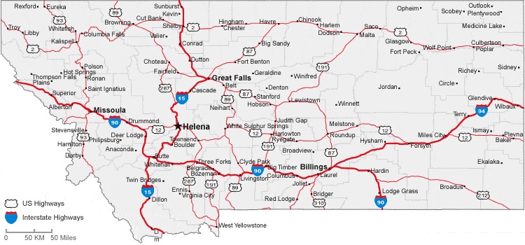
The first map is about the City map of Montana, and this map shows all cities of this state. You can locate any city with the help of this map. This map also shows all counties. The second one is related to the map of Montana with towns. As you can see on the map, all towns are visible, along with interstate highways and city roads. A thick red line indicates all interstate highways of Montana.
This is a list of some major city of Montana state, have greatest population.
| Rank | City | Population |
| 1 | Billings | 117116 |
| 2 | Missoula | 73489 |
| 3 | Great Falls | 60442 |
| 4 | Bozeman | 53293 |
| 5 | Butte-Silver Bow | 35133 |
| 6 | Helena | 32091 |
| 7 | Kalispell | 24558 |
| 8 | Belgrade | 10460 |
| 9 | Anaconda-Deer Lodge County | 9421 |
| 10 | Havre | 9362 |
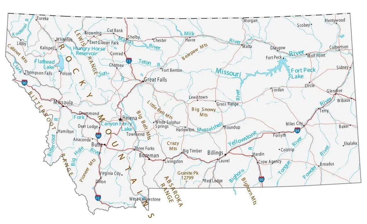
The third map is related to the detailed map of Montana cities and towns with roads, and this map contains all cities and their national highways. So, this is a detailed City map with roads and highways. The fourth map is a large and detailed Map of Montana’s Cities and Towns, showing all the villages, cities, towns, counties, and tourist places. It is a complete map of Montana state in high-quality. And on this map, you can also know about all parks, malls, beaches, airports, railroads, street roads, city roads, interstate highways, and other states’ highways.
This is list of cities and towns of Montana with lageest area.
| Name | Area (mi²) |
| Anaconda | 736.68 |
| Butte | 715.76 |
| Big Sky | 120 |
| Wheatland | 74.45 |
| Sedan | 60.96 |
| Lame Deer | 55.59 |
| Trego | 51.21 |
| Niarada | 49.48 |
| Helena Valley Northeast | 46.5 |
| Fort Belknap Agency | 45.5 |
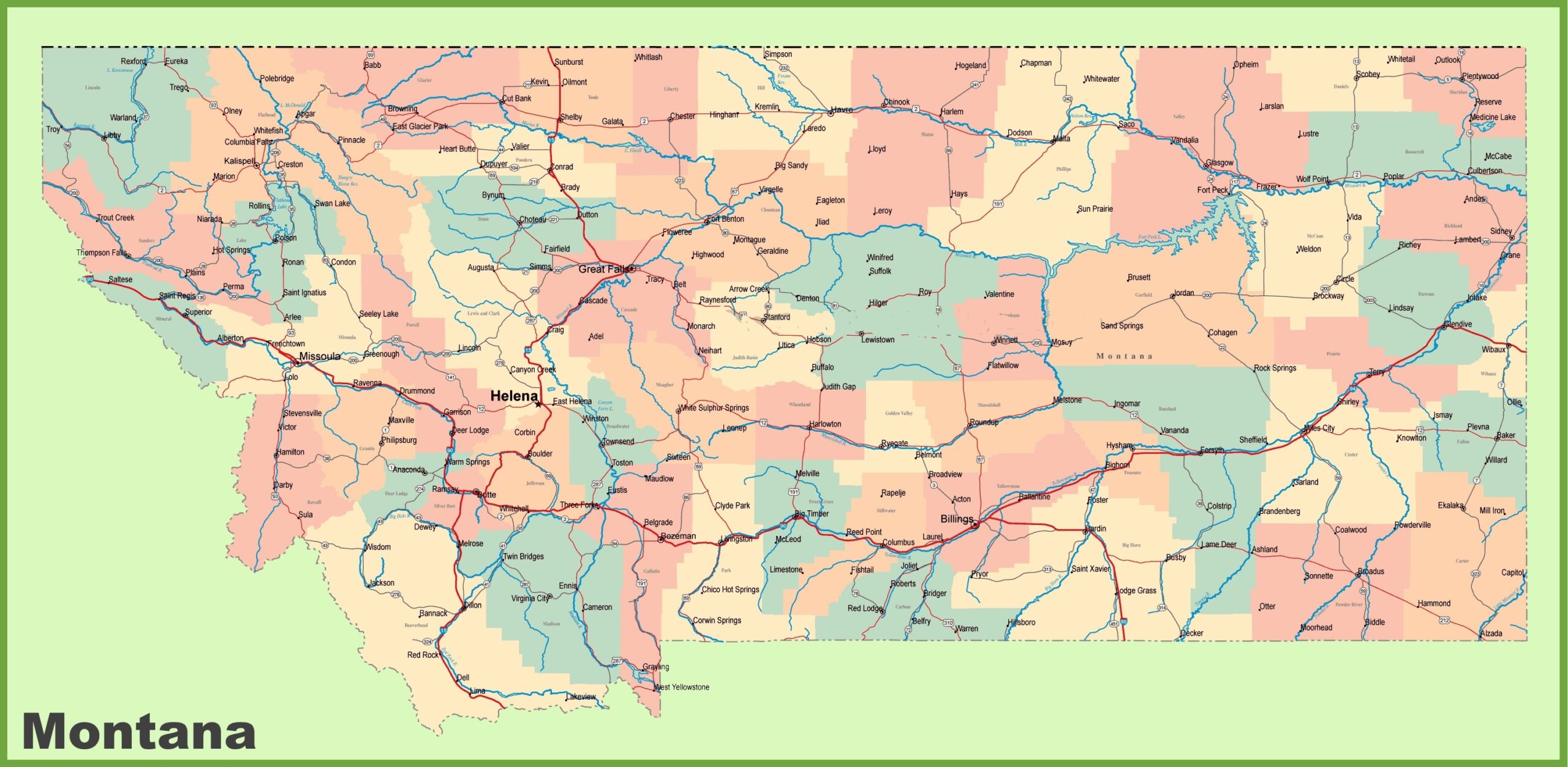
The fifth map is related to the county map of Montana state. You can easily identify any county with the help of this map. The last map is related to the main state map, which shows all counties and major cities on the map. This map also indicates highways, major roads, railway lines, the state capital, etc. All the maps are available in PDF format and Image format. You can easily download any map by clicking on the buttons under the preview image of a particular map. You can also print these high-quality maps for any of your purposes.