Ohio is a beautiful state of the USA, located in the Midwest region of the country. This state has three nicknames, which are as follows: “The Buckeye State”, “Birthplace of Aviation”, and “The Heart of It All”. Columbus is the largest and capital city of Ohio. This state is very famous for aeroplanes, buckeye American football and astronauts. You can learn more about this state. And, here on this page, we are adding some useful information in the form of interactive maps. So, please scroll down the page and check our collection of maps related to Ohio’s state, city, towns and counties. Let’s start with a map of Ohio.
Ohio State Maps Collection:
1. Ohio Map:

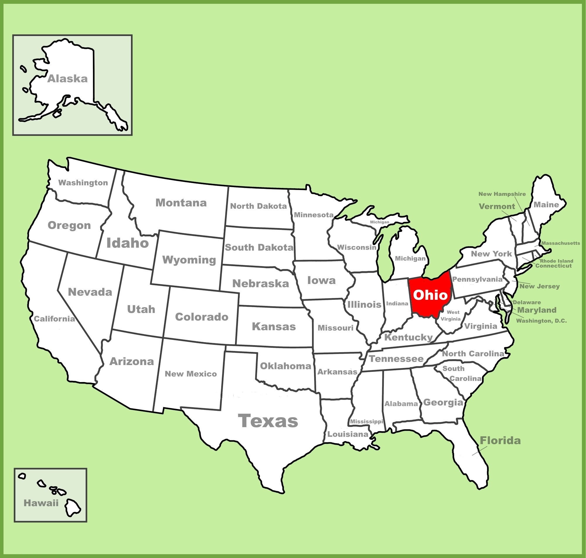
2. Ohio on US Map:
3. Google Map of Ohio:
4. Satellite Image of Ohio:
5. Outline Map of Ohio:
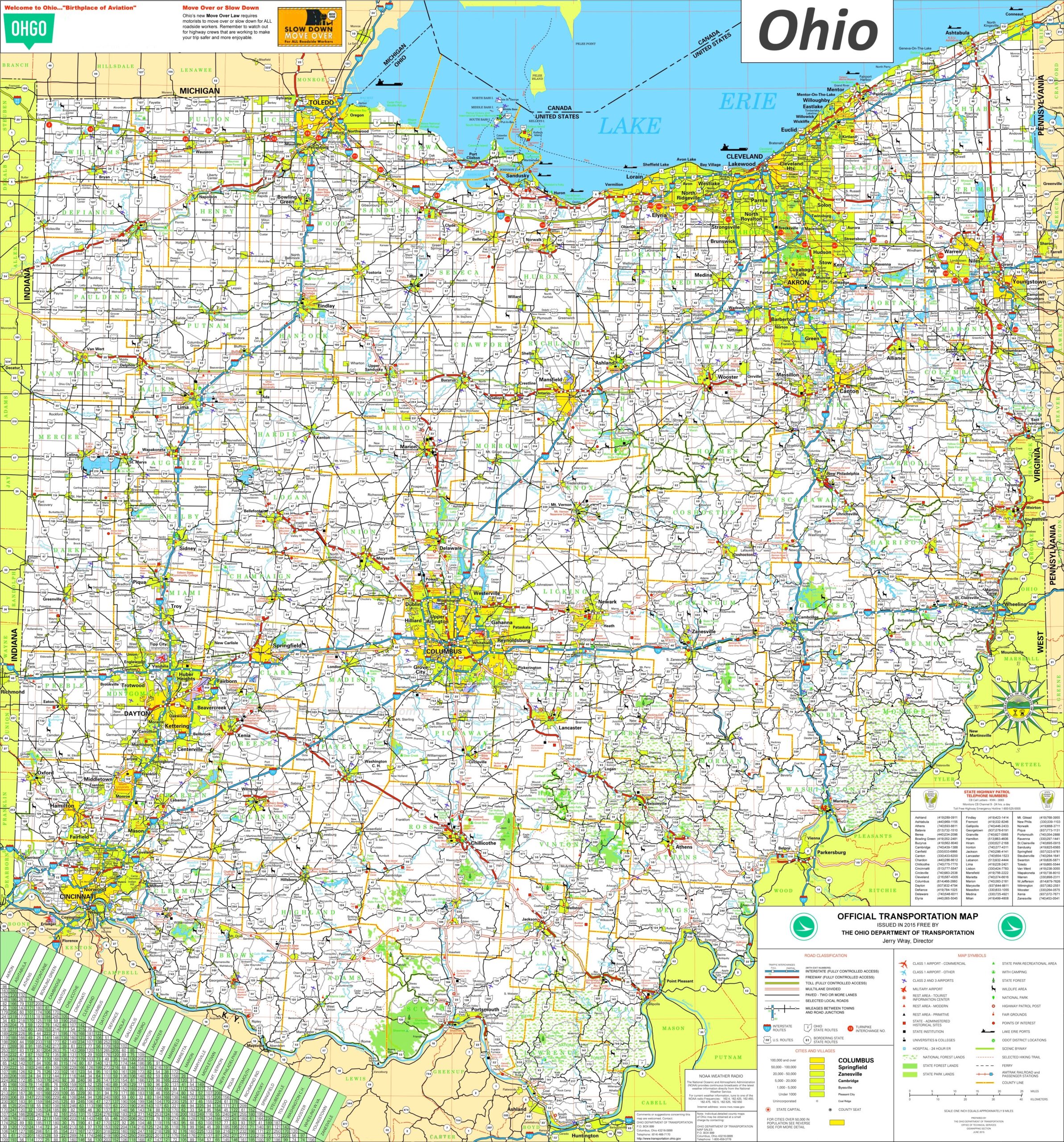
6. Detailed Map of Ohio with Cities and Towns:
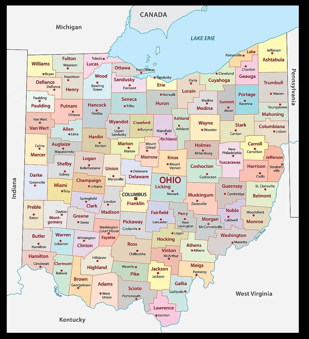
7. County Map of Ohio:
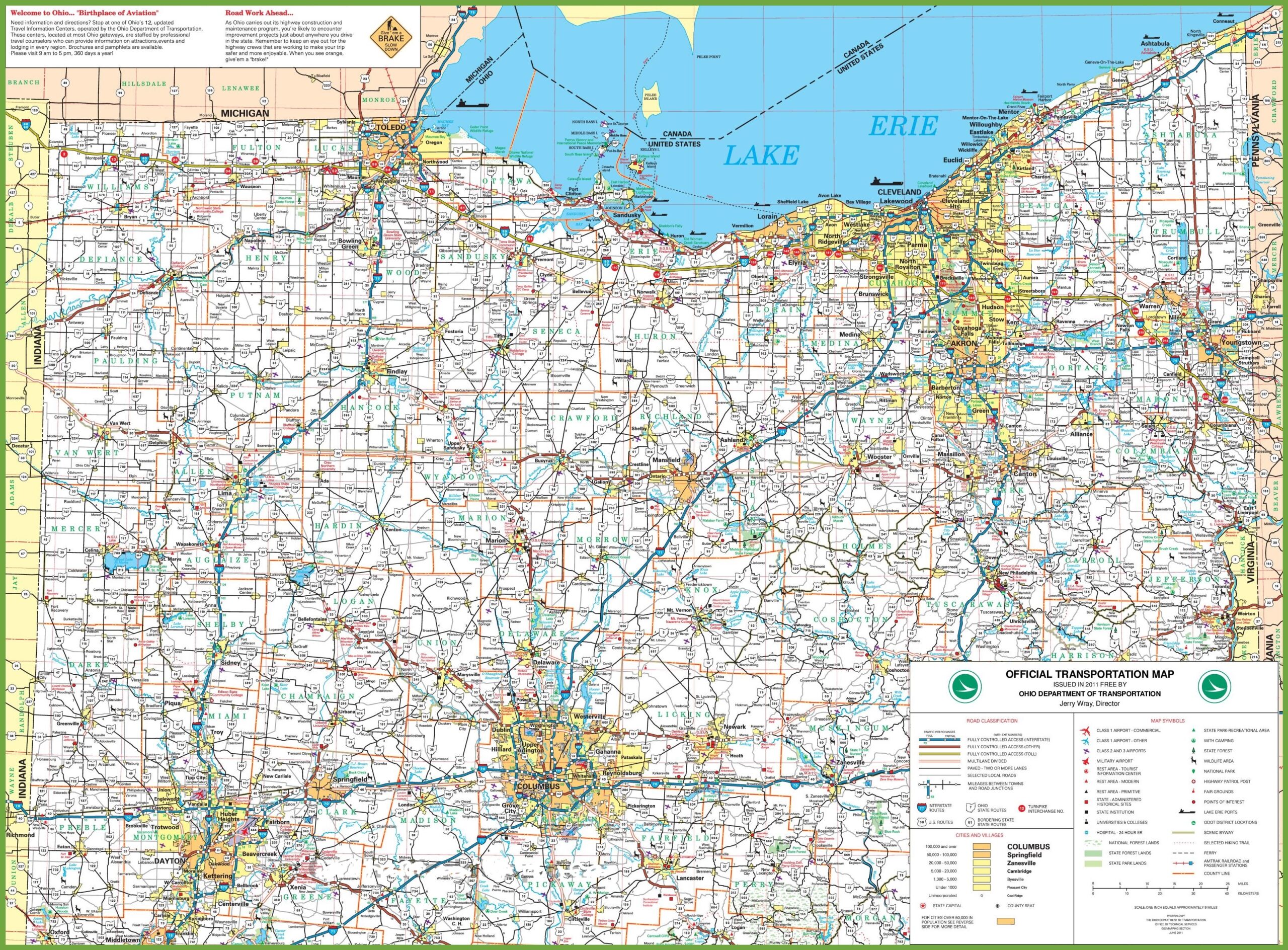
8. Map of Northern Ohio:
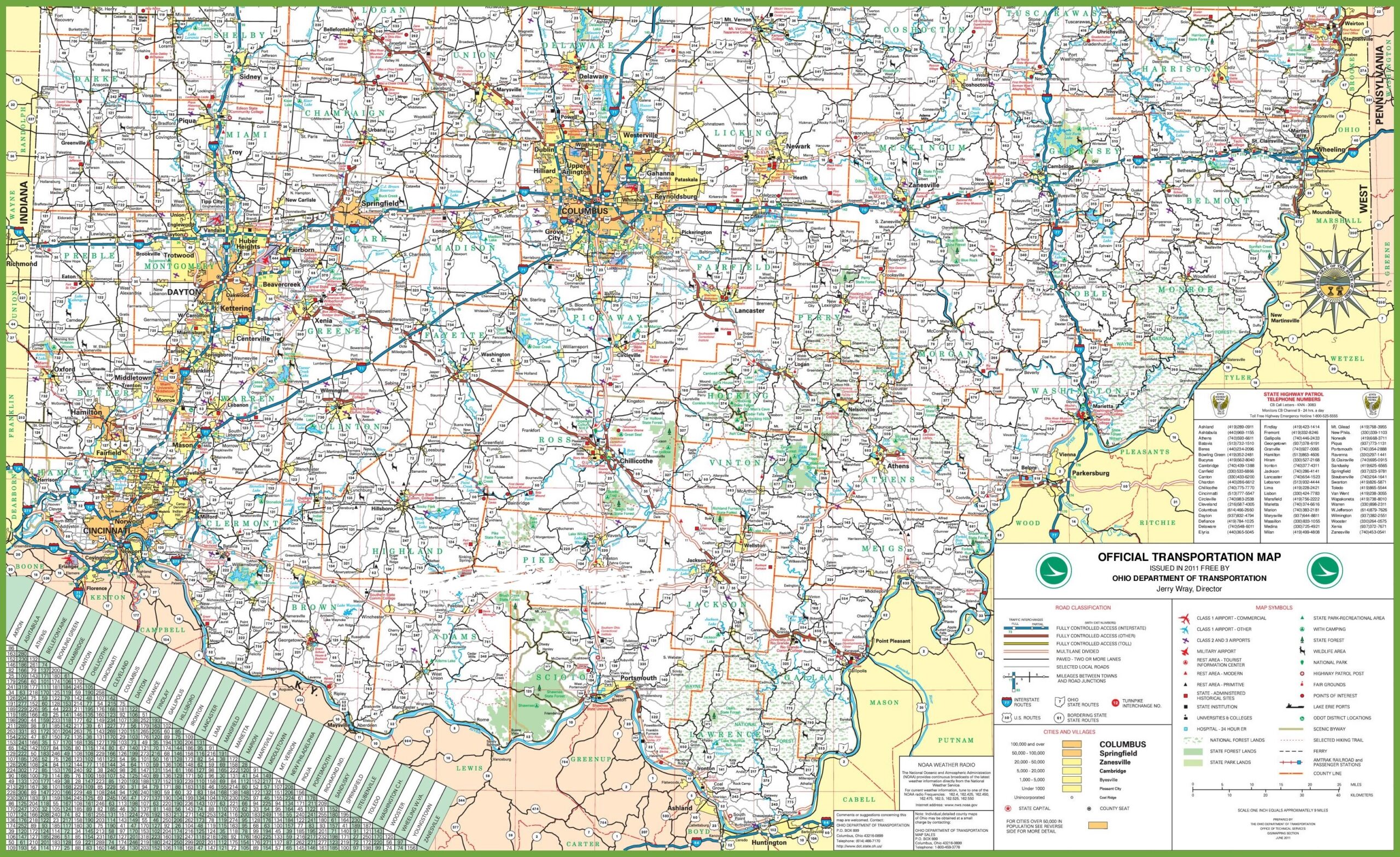
9. Map of Southern Ohio:
Here, we have added ten different types of OH State map. Each map contains some useful information. For you, we are adding some more useful information about each map here.
The first map is related to the detailed state map of Ohio, and this map shows some cities, counties, lakes, rivers, hills and mountains. You can easily identify any major location with the help of this map. The second map shows the location of Ohio state on the USA Map. As you can see in the map, the area filled with red colour indicates its location on the country map.
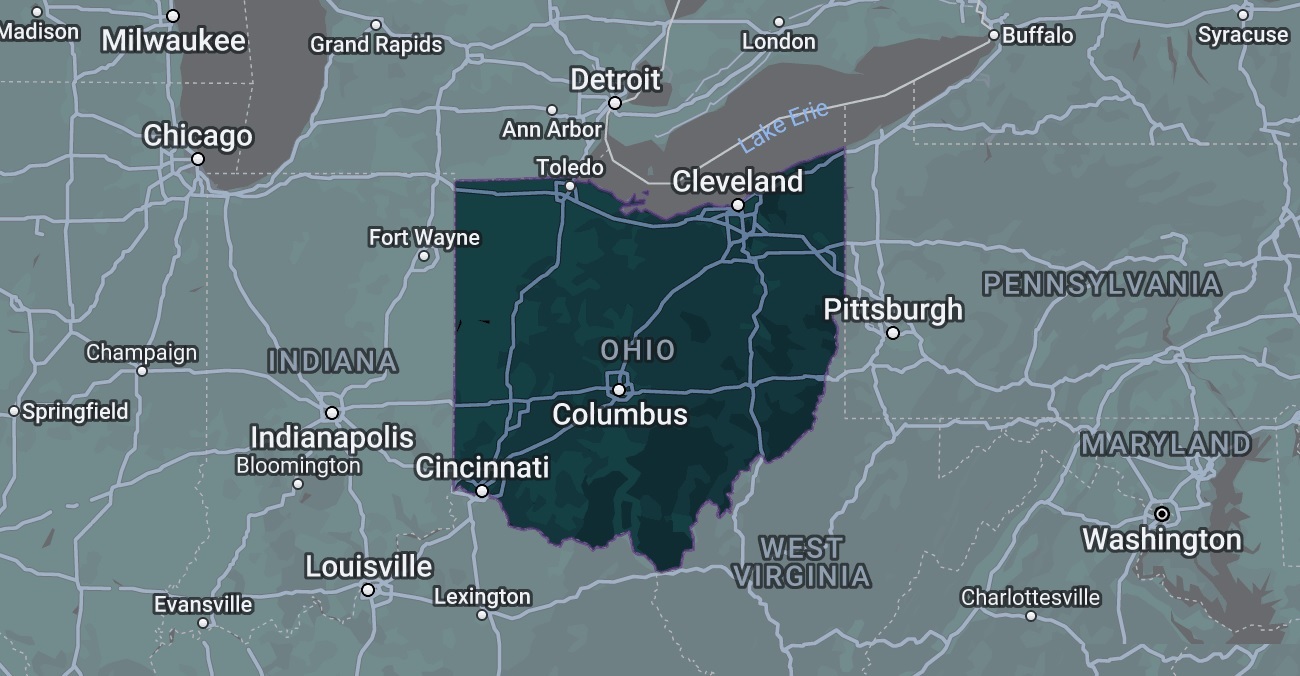
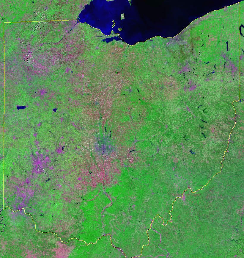
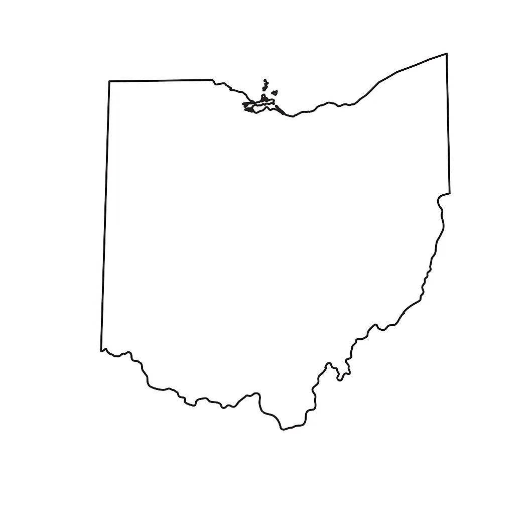
The third map is titled “Google Map of Ohio.” This map is a Google map version of this state which shows some cities, towns, and the capital city. The fourth map is a Satellite image of this state which shows the structure of this state. You will only see the outer boundary on this map. So, if you want a detailed map of this state, please check the first map. Now, the fifth map is an outline or blank map of Ohio, which shows the outer boundary. The sixth map is also similar to the previous map but visually different. So, this map is a kind of topographic map used for geographical purposes. This map shows the boundaries of all counties with some water bodies.
The seventh map is related to the county map. It is a full-detailed OH county map with cities. County seats are also shown on this map. The eighth map is a large and detailed map of Ohio with cities and towns. This map shows all cities, towns, roads, highways, railroads, airports, beaches, rivers, lakes, mountains, etc. The next two maps are the specific area map of Ohio State. On the eighth map, you will see all cities, towns and roads of Northern Ohio, and on the last map, you will get to know all cities, towns and roads of Southern Ohio. Both maps are the regional maps of Ohio state.
So, these were some best and most useful maps of Ohio that we have added above. All the maps are available in PDF format and JPG format. You can easily download any map by clicking on the buttons under the preview image. All these maps are free to download.