Maine Department of Transportation (MaineDOT), also referred to as MDOT, maintains all the roads and highways of Maine(ME) state. In this state approx 22,236 miles area covered by roads and highways. So, if you want to travel in this state, you must have some Maine Road Maps and Highways Maps. So, let’s start with these maps.
Maine Road and Highway Maps Collection:
1. Maine (ME) Road Map:

2. Maine (ME) Highway Map:
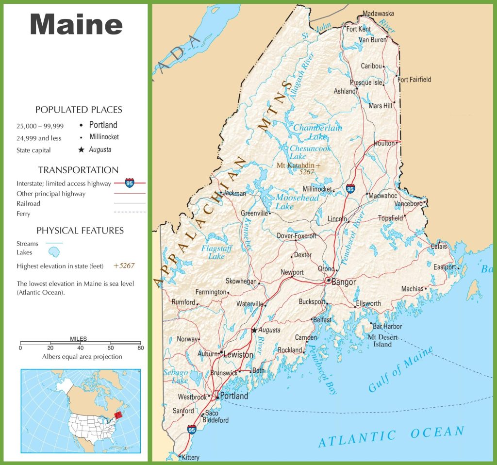
The first map contains details of roads and their routes connecting all places and other cities of Maine State. Thus, you can easily identify any direction and navigate anywhere inside any city.
The last map is about Maine Highway Map contains all the information about interstate highways, state routes, and U.S. routes that are stretched inside the state.
Maine is a beautiful state which is situated in the New England region of the United States. In this state, the total length of roads and highways is 35,785 kms. Maine has one primary Interstate highway, which is I-95, and the length of this highway is 488 kilometres. And, there is only U.S. numbered highways which are U.S. Route 1 and U.S. Route 2. The U.S. Route 1 is the most interesting and scenic route in the entire state. You will feel very amazed and also enjoy the beautiful views on this highways. Landscapes and the coastallines are the main interaction point on this route.
There are approx 100 states routes in Maine that the MDOT controls. In Maine, State Route 11 (S.R. 11) is a state highway that is the longest, and the total length of this highway is 645 Kms.
There are lots of to explore in Maine State. However, if you’re planning to visit this state, you must check the maps above. During your visit, you can discover the Wildlife, National Parks, and Historical Towns. Mainly the state is known for its coastline and beautiful lighthouses. Here, we are giving you some information about some best places to visit in Maine State. The places’ names are as follows: Bar Harbor, Acadia National Park, Camden, Ogunquit, Rockland, York, Augusta, Sugarloaf Mountain, etc. You can visit any place to experience the beauty of this state.
You can download any of these maps using the PDF and JPG buttons under all preview images. These maps are easy to access for everyone and available free of cost.