Roads are an important part of any state or city. Roads and Highways of Massachusetts are maintained and controlled by the Massachusetts Department of Transportation (MassDOT). So, if you are planning to travel within Massachusetts State then you must have a Massachusetts Road Map and Highway Map. So, below we’re adding some best maps that would be helpful for you. So, scroll down the page and have a look.
Massachusetts Road and Highway Map Collection:
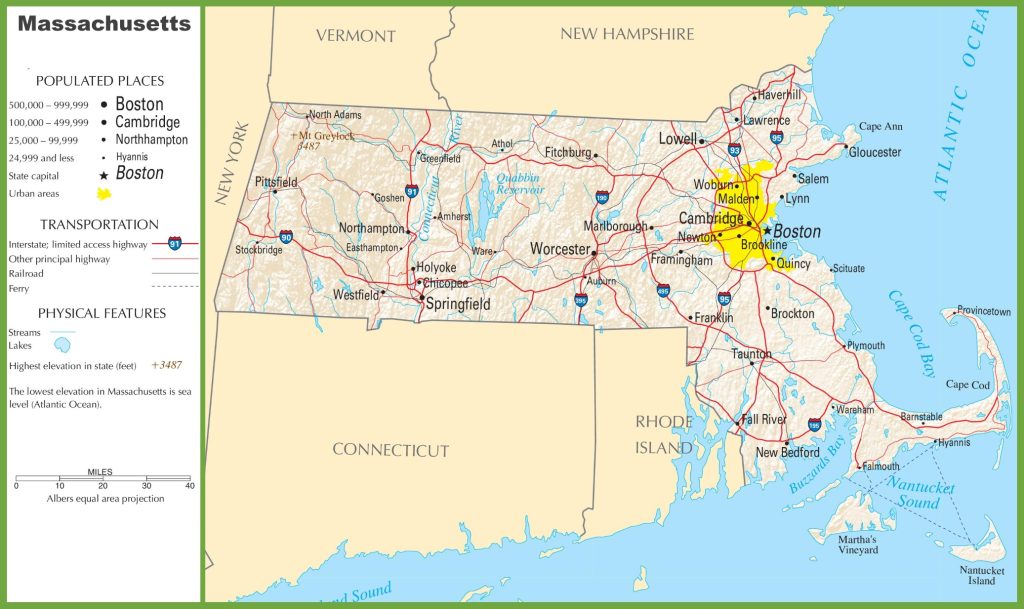
1. Massachusetts Road Map:

2. Massachusetts Highway Map:
As you can see there are two different maps that we have here. Each map contains some useful information. With the help of these maps you can easily identify any direction and navigate anywhere inside any city. Below we are describing some brief descriptions of each map that is shown above.
The first map which is the “Massachusetts Road Map“. On this map, you will get to know information about all cities and their roads. So that you can easily identify any road and navigate to anywhere.
When you will check the last map which is titled “Massachusetts Highway Maps“. And, when you open this map you will find information about all major highways, interstate highways, US highways of this state. All highways are indicated by thick red lines.
The longest highway in Massachusetts is I-90 which is 136 miles long and the shortest highways are I-84 and I-86 which are 13.12 kilometers long. MassDOT Highway Division design, construct and maintains all the roads, highways and other street roads.
All the maps are available in PDF format as well as in JPG (Image) format. You can easily download any map by clicking on the buttons that are under the preview image of a particular map. And if you have any suggestions regarding these maps, then please tell us by using the comment section below.