Omaha is the largest city in the U.S. state of Nebraska. The roads and highways are controlled by the Nebraska Department of Transportation (NDOT) and the Nebraska Department of Roads (NDOR)/ If you want more details or information about the roads then you must check the Omaha Road Map that we are adding below. So, let’s start with this map.
1. Omaha Road Map:
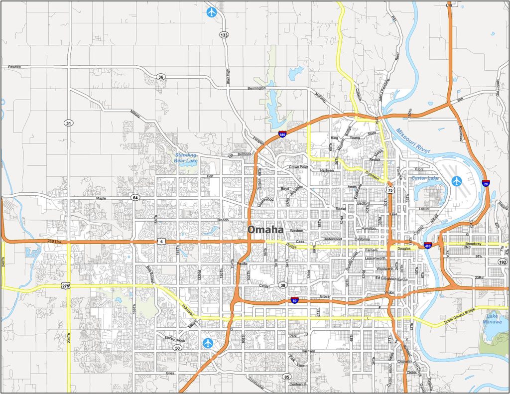
In this map, you will see information about all the roads of Omaha City. With the help of this map, you can easily navigate inside this city. All interstate highways are indicated by the Orange line and also marked with the unique highway number.
These were some best road and highways map of Omaha city that we have added above. This map is available in PDF format as well as in JPG (Image) format. You can easily download this map by clicking on the buttons.
So, these were some best road and highways maps of Wyoming State that we have added above. All maps are available in PDF format as well as in JPG (Image) format. You can easily download any map by clicking on the buttons. And, these maps are available free for you.