West Virginia has 233 cities, towns and boroughs that covers an area of 24,230 square miles that includes 24,078 sq miles of land and 152 sq miles of water. If you are here to learn more about the cities and towns of this state through its maps then you must check the collection maps that we are adding below. Please scroll down the page and let’s start with a West Virginia Town map and other maps related to cities and villages of WV, USA
Maps Collection of West Virginia Cities and Towns:
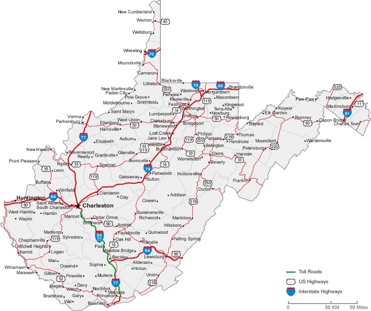
1. Map of West Virginia with Cities:
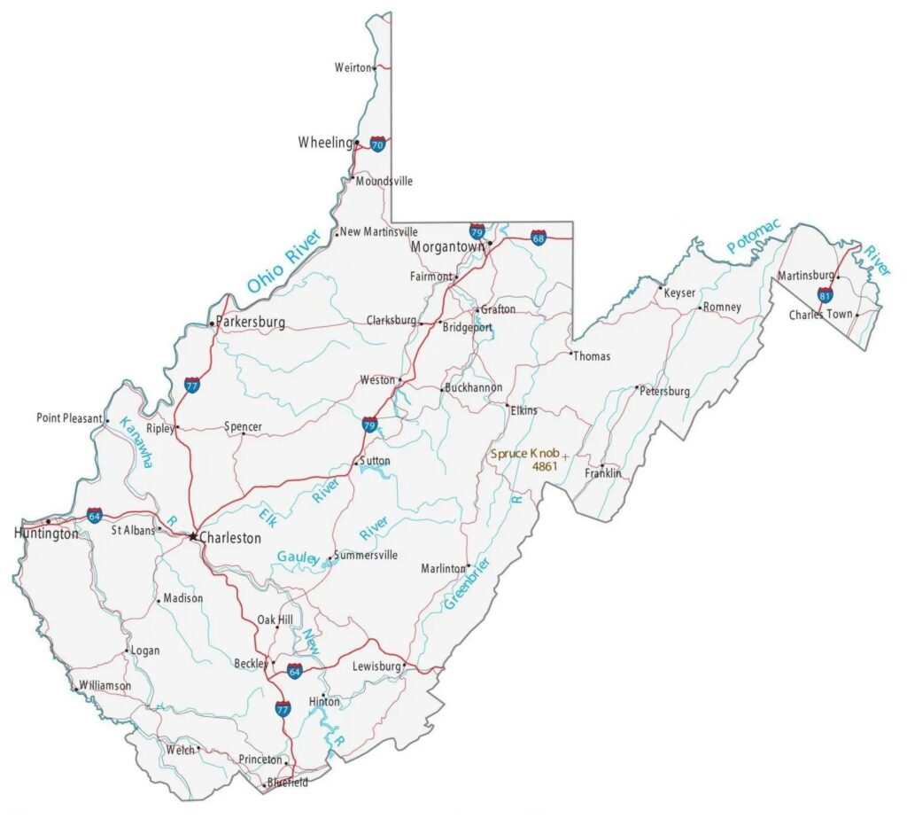
2. Map of West Virginia with Towns:
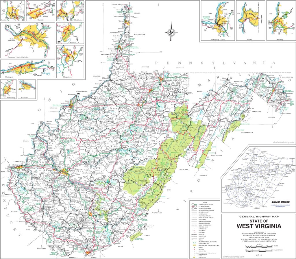
3. Map of West Virginia Cities and Towns:
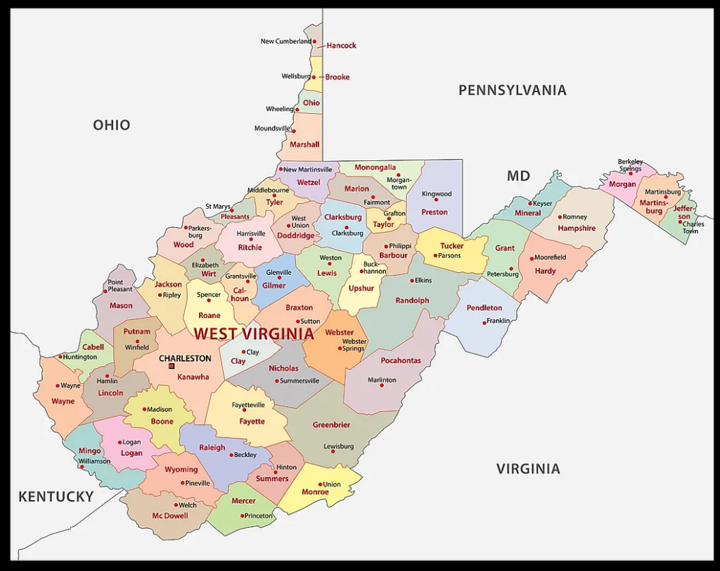
4. West Virginia County Map:
5. West Virginia Map:
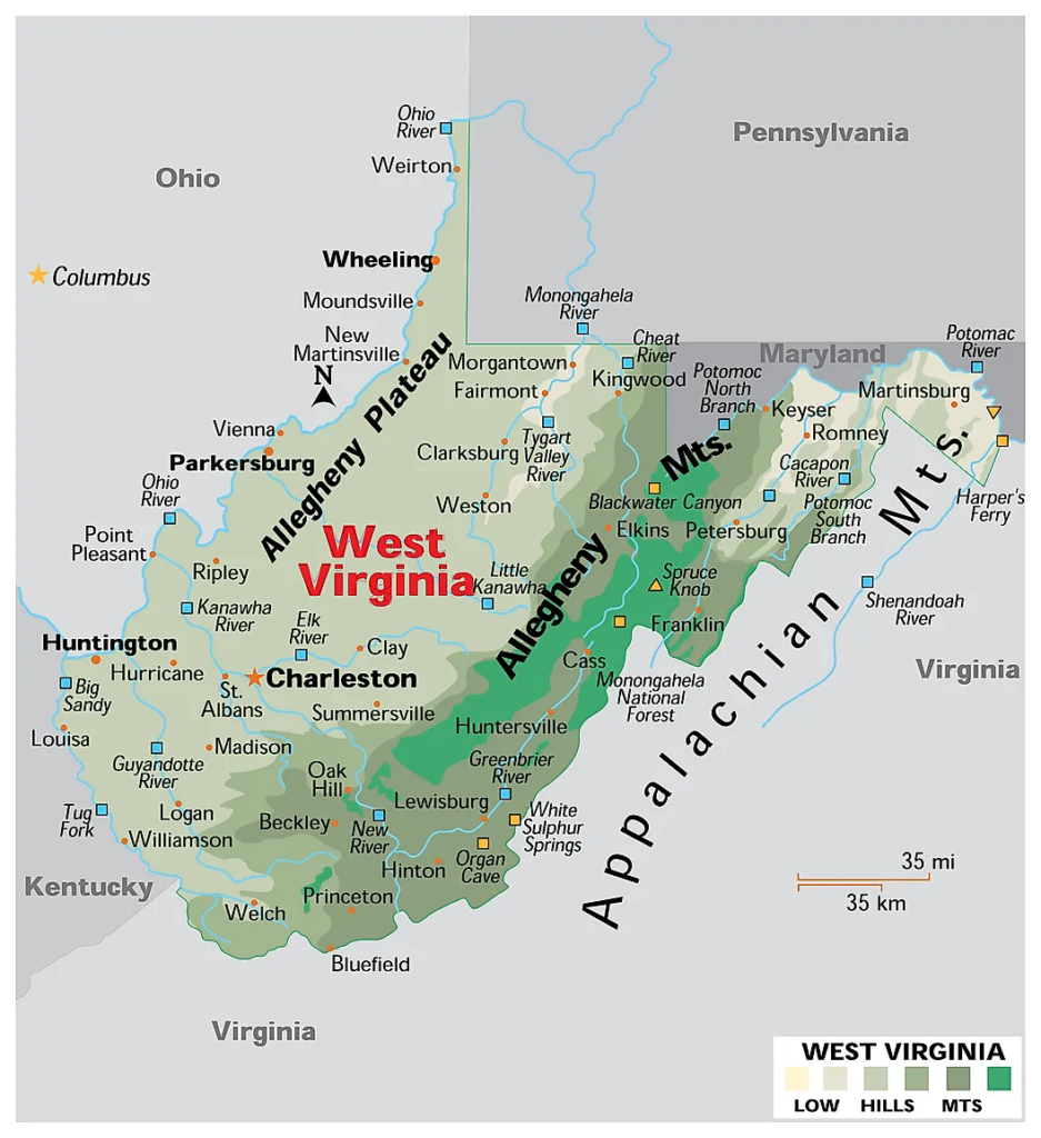
This is the collection of maps of West Virginia Cities and Towns that we have added above. We have added five different maps that contain some helpful information. Below, we are also adding some brief information about each map. So, please read the full description of each map.
The first map is about the city map of West Virginia state, and this map shows all cities. You can locate any city on this map. This map also shows all counties. The second is related to the Town map of this state. As you can see on the map, all major towns are visible, along with some interstate highways. A thick red line indicates all interstate highways of this state. The third map is a large and detailed Map of West Virginia Cities and Towns, shows all the cities, towns, counties, other significant places and tourist places. And on this map, you can also know about all parks, malls, beaches, airports, railroads, street roads, city roads, interstate highways, and other states’ highways.
The fourth map is related to West Virginia County map. You can easily identify any county with the help of this map. The fifth map is related to the main state map of this state, which shows all counties and major cities on the map. This map also shows national highways, major roads, water bodies, railway network, the state capital, and major towns. So, these were some large and printable West Virginia Cities & Towns maps that we have added above. All these high-quality maps are available in PDF format and JPG (Image) format. Download any map for free.