In our lives, roads have an important role. These roads help us to go anywhere around the country. All the people are well connected to their loved ones who are residing far from them. If you have a project related to roads or you are a researcher then, you must have a road map of Florida.
Collection of all Road Maps of Florida:
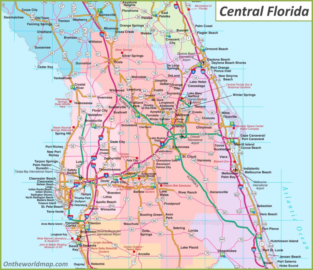
1. Road Map of Central Florida:
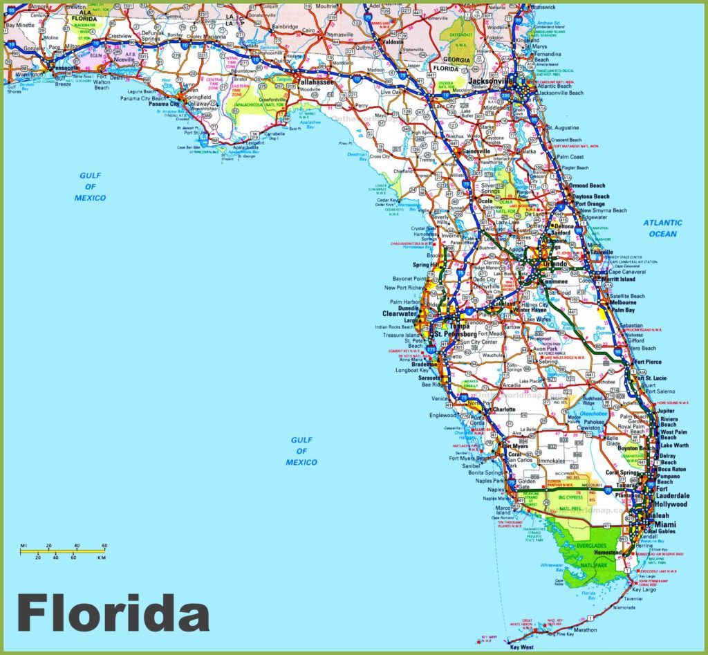
2. Road Map of Florida:
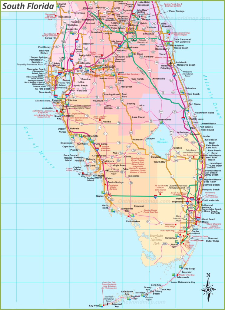
3. Road Map of South Florida:
4. Road Map of North Florida:

As you can see that we have included four types of road maps. The top one shows all the maps of Central Florida. All the cities and roads are shown on this map are those which lies in Central Florida. The second one shows the full road map of Florida. It includes all types of roads such as village roads city roads, etc with city names on labeled on it.
The third image shows the detailed road map of South Florida. All the cities, towns, and roads are showing on this map are of southern Florida. The fourth one shows the detailed atlas of North Florida. All the cities, towns, and roads are showing on this map are of Northern Florida.
Now, you may be confused to get these maps in your smart devices. Let us tell you to get these maps in easy steps. All you have to do is click on the PDF button as shown under a category of a map. After clicking on this, a new tab will be open and there you’ll find a PDF of a map.
Now, you have two options either you can download this map or you can take a print out by pressing ctrl+P. The choice is yours.