The United States 3d maps are often used by artists to add dimensions and depth. Basically, 3D mapping is based on a projection method. If you are looking for a 3D Map for your projects, then you are in the right place. Have a look at these maps we have shown below and choose accordingly.
Collection of 3D Maps of U.S.A:
1. Colorful 3D U.S Maps:

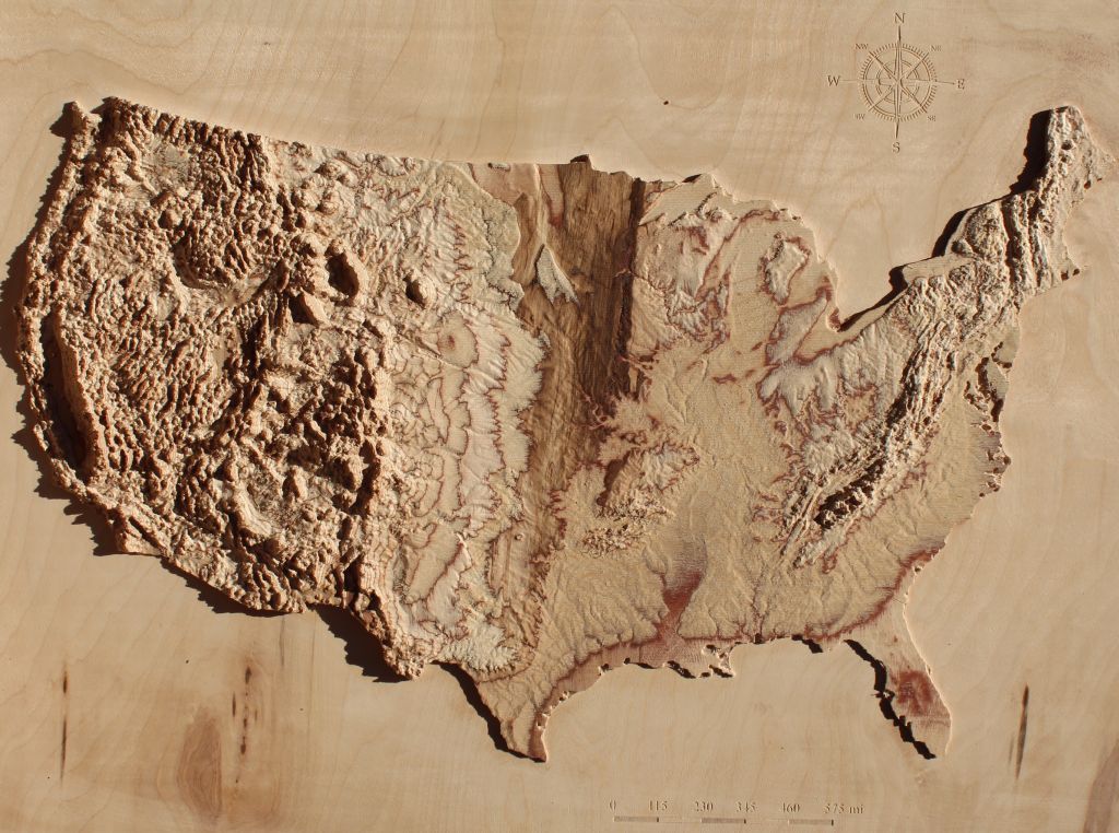
2. 3D Elevation U.S Map:
3. 3D Map of United States:

Most of the time 3d maps are commonly used for school projects. 3d maps are used to discover the insights which can not be done in two-dimensional maps. You can plot geographical data of the region on a 3d Map. Here we have listed 3 types 3d map of USA, colorful 3d U.S map, 3d elevation U.S map, and 3d maps of United States.
In the first image of 3d U.S map, you can see a colorful map. It is showing the depths of all the state boundaries. This type is used to understand the details of state boundaries of the United States. In the second image of 3d elevation map, it is an ariel view of a 3d map. It shows all the hilly areas of the United States clearly. You can get an idea about the depth of these hilly areas.
As you can see in the third image of the United States 3d map, It is a geographical and colorful image of 3d U.S map. All these maps are best for you. You can choose one of these maps for your projects. You don’t need to pay for it. All these maps are available free of cost. All you have to do is, press the PDF button of a particular 3d map category, a pdf will be open in anew tab after that you will be able to download the map.
Must share your experience with these amazing collection of maps. Tell us about in which project you have used all these maps. If you have any suggestions or you want any other type of United State maps please let us know by commenting down here.