Vermont is located in the New England region of the USA. This state has fourteen counties. You can explore more about the counties of Vermont on this page. Because, here on this page you can find some printable Vermont county map that will help you a lot. So, scroll down the page and check our collections of maps related to Vermont State’s Counties and Cities. You may also check a full HD map of Vermont state by click this link.
Vermont (VT) County Maps Collection:
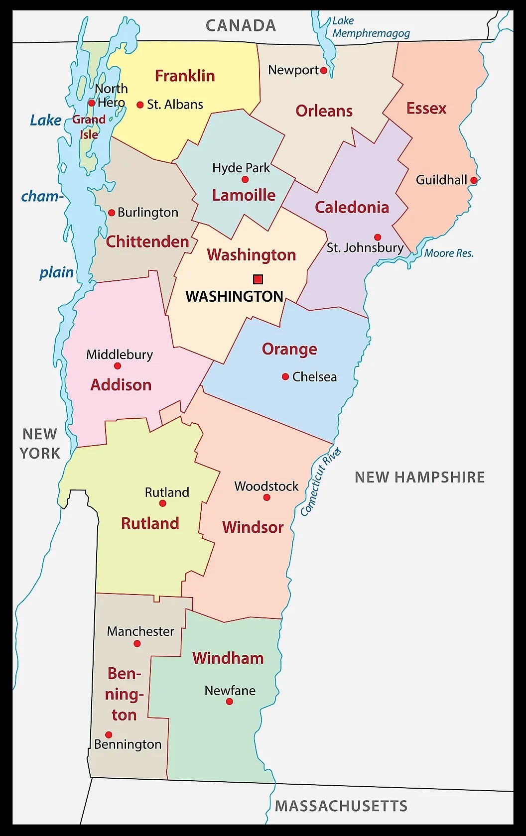
1. Map of Vermont with Counties:
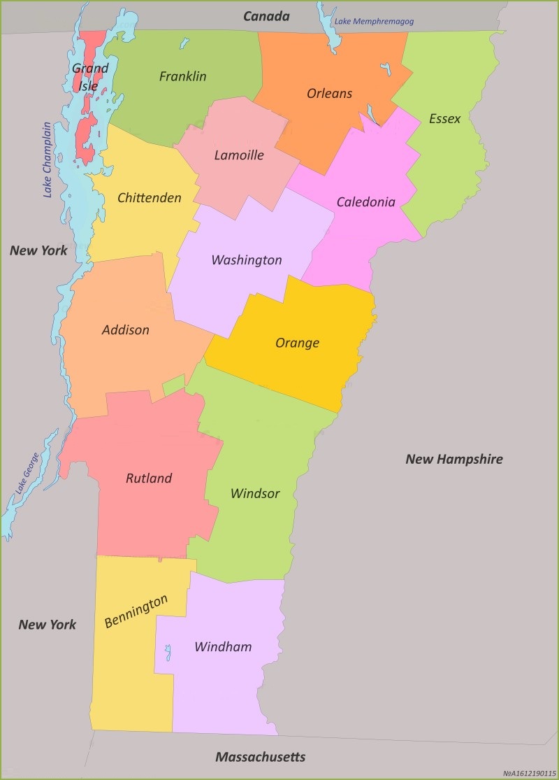
2. County Map of Vermont:
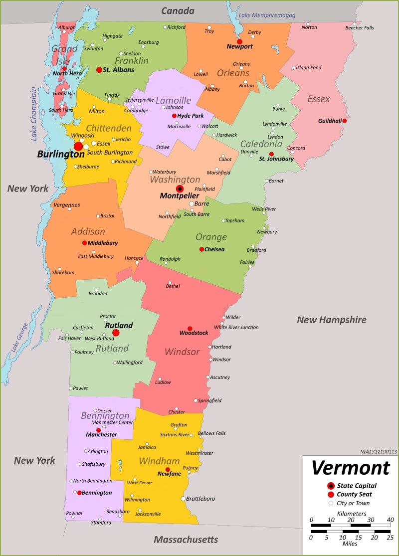
3. VT County Map
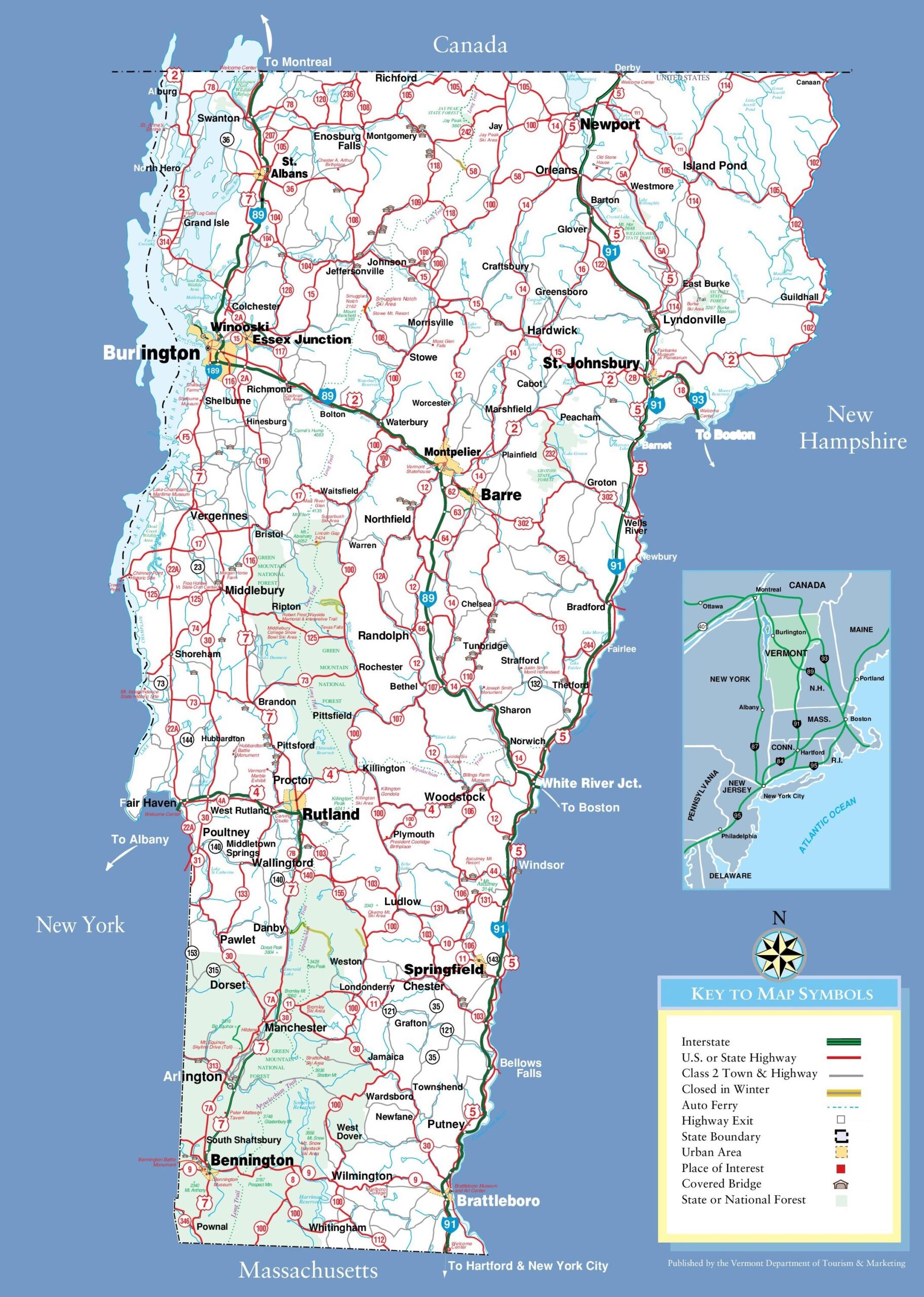
4. Map of Vermont Towns:
5. Map of Vermont:

This is the collection of some high-quality VT county map that we have added above. We have added a total of five different maps that contain some helpful information about the counties and cities of Vermont state. Here, we are adding some brief information about each map. So, please read the full description before downloading any map from the above collection.
The first map is a main county map of Vermont, which shows only county names. And the next map is also a map of Vermont with counties but it is visually different. The third map is Vermont county map with major cities and towns. Below we are also adding a table that shows some useful information about the counties of Vermont. Please read the entire table for additional information.
Counties in Vermont, USA:
This is a list of all counties of Vermont with some useful information like name of county, the county seat, year of established in and total area.
| County | Est. | Area | Population |
| Addison County | 1785 | 770 sq mi | 37363 |
| Bennington County | 1779 | 676 sq mi | 37347 |
| Caledonia County | 1792 | 651 sq mi | 30233 |
| Chittenden County | 1787 | 539 sq mi | 168323 |
| Essex County | 1792 | 665 sq mi | 5920 |
| Franklin County | 1792 | 637 sq mi | 49946 |
| Grand Isle County | 1802 | 83 sq mi | 7293 |
| Lamoille County | 1835 | 461 sq mi | 25945 |
| Orange County | 1781 | 689 sq mi | 29277 |
| Orleans County | 1792 | 697 sq mi | 27393 |
| Rutland County | 1781 | 932 sq mi | 60572 |
| Washington County | 1810 | 690 sq mi | 59807 |
| Windham County | 1779 | 789 sq mi | 45905 |
| Windsor County | 1781 | 971 sq mi | 57753 |
The fourth map is a main VT map of the county with Cities that shows all counties, major cities, city roads and interstate highways. And the last map is a detailed map of the state of Vermont. All major cities and towns are visible on this map with all major roads. And some water bodies like Lakes and Rivers are also shown on this map. So, these were some printable maps that we have added above. These large maps are available in PDF and JPG (Image) formats. You can easily download any map by clicking on the buttons under the preview image. All these maps are free to download.