Utah is located in the mountain west subregion of the USA, which is a part of the Western United States of America. This is the 13th largest state by area, which covers almost 219,887 km2 (84,899 sq. mi) of the area, including 82,144 square miles of land and 2,755 square miles of water. Approx. The length of Utah is 350 miles, and the width is 270 miles. And, this state has a population of approx. 3,271,616. If you want to know more about this state, you should initially start with the maps of Utah state. Here on this page, we are adding some best Utah map with Cities and towns. So, please scroll down the page and check our collections of maps. And for detailed information, you may also check Utah maps.
Maps Collection of Utah Cities and Towns:
1. Map of Utah with Cities:
2. Map of Utah with Towns:

3. UT city Map:

4. Utah Map with Cities:
5. UT Map:
6. County Map of Utah:
This is the collection of maps of Utah Cities and Towns that we have added above. We have added five different maps that contain some helpful information. Below, we are also adding some brief information about each map. So, please read the full description before viewing or downloading any map from the above.
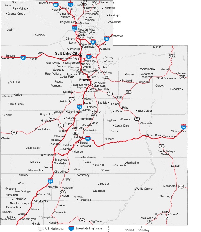
The first map is about the city map of Utah state, and this map shows all cities of UT. You can locate any city on this map. This map also shows all counties. The second is related to the Town map of this state. As you can see on the map, all major towns are visible, along with some interstate highways. A thick red line indicates all interstate highways of this state. The third map is a combine map of towns and cities of Utah, this map also shows all counties of Utah. You may also check the county map of Utah for more detailed information.
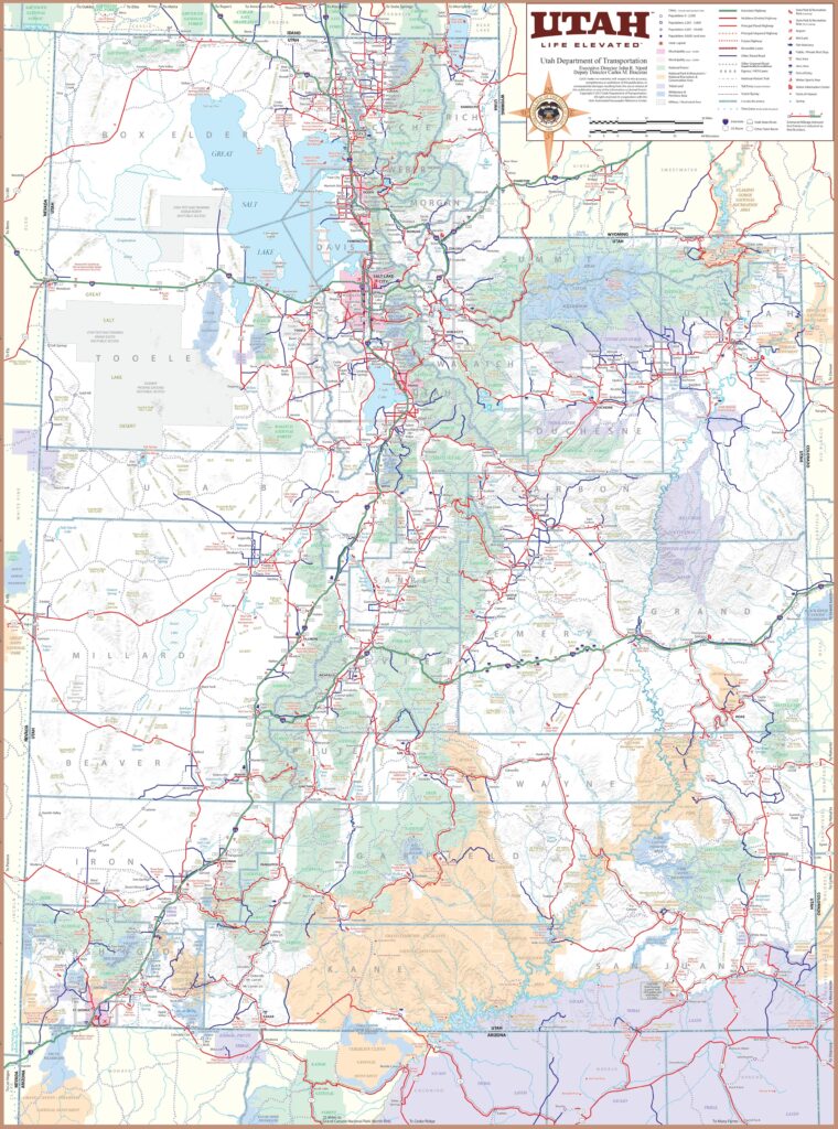
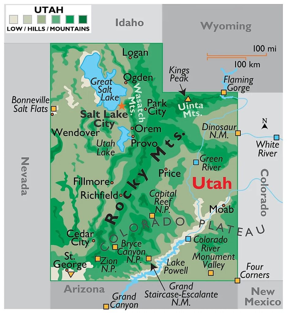
The fourth map is a large and detailed Map of Utah Cities and Towns, shows all the cities, towns, counties, other significant places and tourist places. And on this map, you can also know about all parks, malls, beaches, airports, railroads, street roads, city roads, interstate highways, and other states’ highways. The fifth map is related to the main state map of this state, which shows all counties and major cities on the map. This map also shows national highways, major roads, railway lines, the state capital, and major towns.
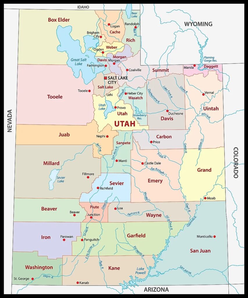
The last map is related to Utah County map. You can easily identify any county with the help of this map. So, these were some large and printable Utah City maps that we have added above. All these high-quality maps are available in PDF format and JPG (Image) format. You can easily download any map by clicking on the buttons under the preview image. All these high-quality maps are free to download.