Texas is a famous state in the United States of America. It is one of the biggest states by population and area. This state is situated in the south-central region of the country. If you are planning to visit this state and want to travel to some cities, you must have detailed and useful maps related to Texas’s Roads and Highways.
Here, we have some best texas road maps with cities and texas state highway maps. Check all these maps and download any map according to your need.
Texas Road & Highway Map Collections:
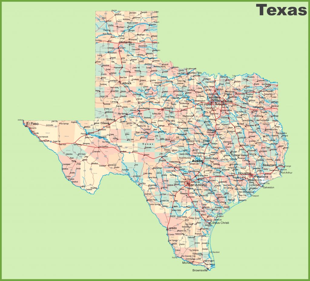
1. Texas Road Map:
2. East Texas Road Map:
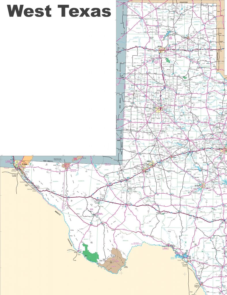
3. West Texas Road Map:
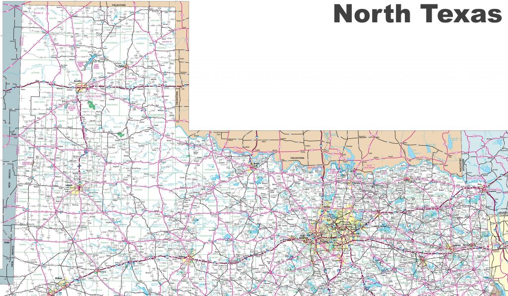
4. North Texas Road Map:
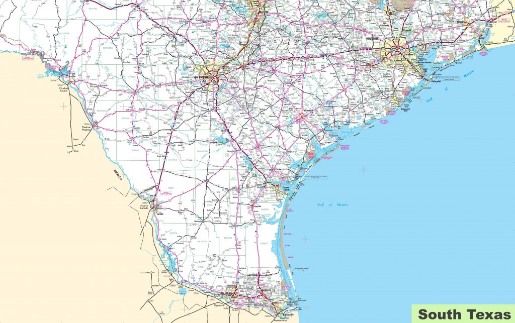
5. South Texas Road Map:
6. Centre Texas Road Map:
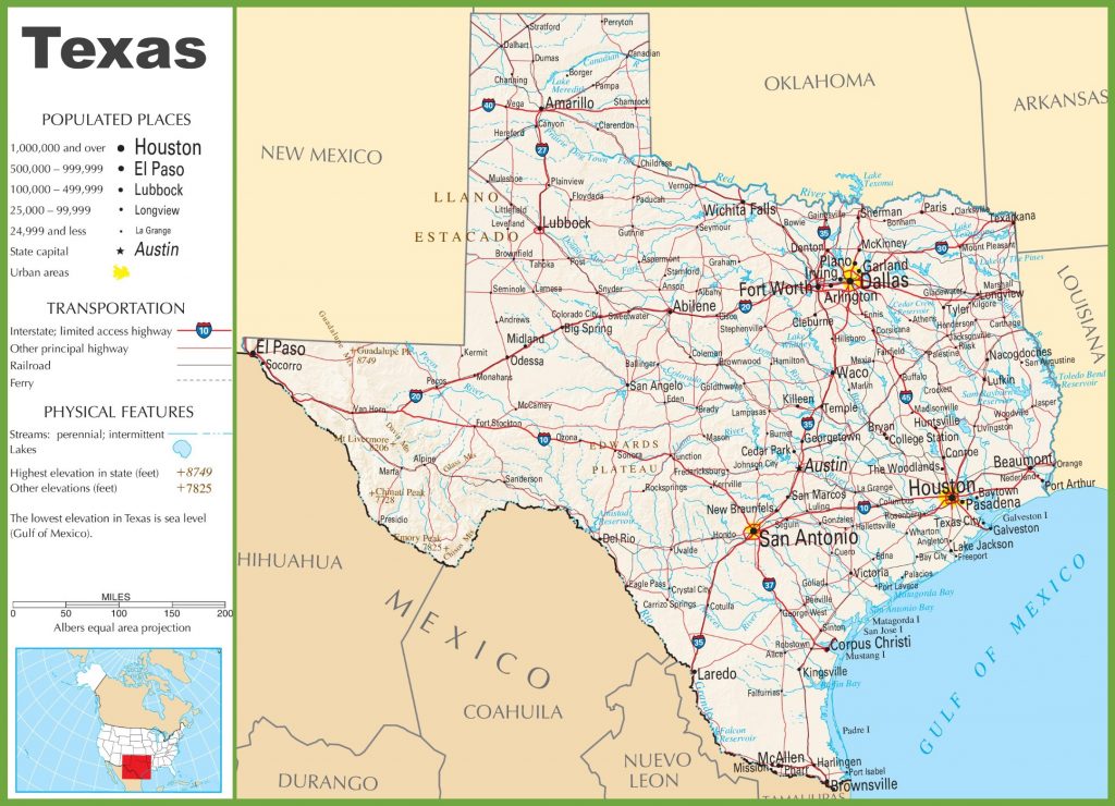
7. Texas Highway Map:
This was the collection of all the road and highway maps of Texas state. There is a total of seven types of different maps that we have provided above. These maps are very useful and contain every single piece of information that you need.
Let’s start with the first section. Here are a total of 06 maps and all maps belong to roads of all cities in texas state. There are also some specific region maps of Texas State. You can easily navigate in all directions of Texas.
When you look at the first map, which is the “Texas Road Map“, there you will see all the roads and their routes. You can easily move from one city to another city in texas state.
Now, in this second map which is the “east texas road map”,. Here, you will get to know all the information about roads that are in East Texas.
When you will check the third map, which is the “west texas road map”. Here, you will get to know all the information about roads in the west direction of Texas State.
When you explore the fourth map, that is the “north texas road map”. Here in this map, you will find all the information about roads in the North Texas area.
Now, in this fifth map which is the “south texas road map”,. Here, you will get to know all the information about roads in the south Texas area. You can easily navigate within this area with the help of this map.
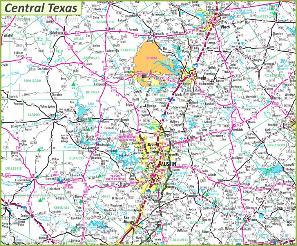
The sixth map is the “central texas road map”. This map includes all the information about roads and their routes in Central Texas.
In the second section, you will check the last map that is “Texas Highway Map“. This map will get to know all highways, interstate highways, US highways, and other principal highways of this beautiful Texas State. A unique number indicates all interstate highways, so you can easily identify them and navigate.
Texas is also known for its natural resources and other things. One of the most famous is cattle. Texas has about 12 million cattle, more than any other state in the country. In this state, there is a very large production of wool and cotton. Texas has more species of birds than any other state of the United States of America, including screech owls and hummingbirds. Texas also has an official nickname which is “The Lone Star State”.
These were some important and useful road and highways maps that we have provided above. All the maps are available in PDF format as well as in JPG (Image) format. You can easily download any map by clicking on the buttons under the preview image of a particular map. And, you don’t need to pay while downloading these maps.