The Roads and Highways of Pennsylvania are maintained by the Pennsylvania Department of Transportation (PennDOT). Pennsylvania has a road network of approximately 41,643 miles (67,018 km). So, if you’re planning to travel in this state, you must have Pennsylvania Road Maps and Highway Maps. So, here we have useful maps of Pennsylvania. Let’s start with these maps.
Pennsylvania (PA) Road and Highway Map Collection:
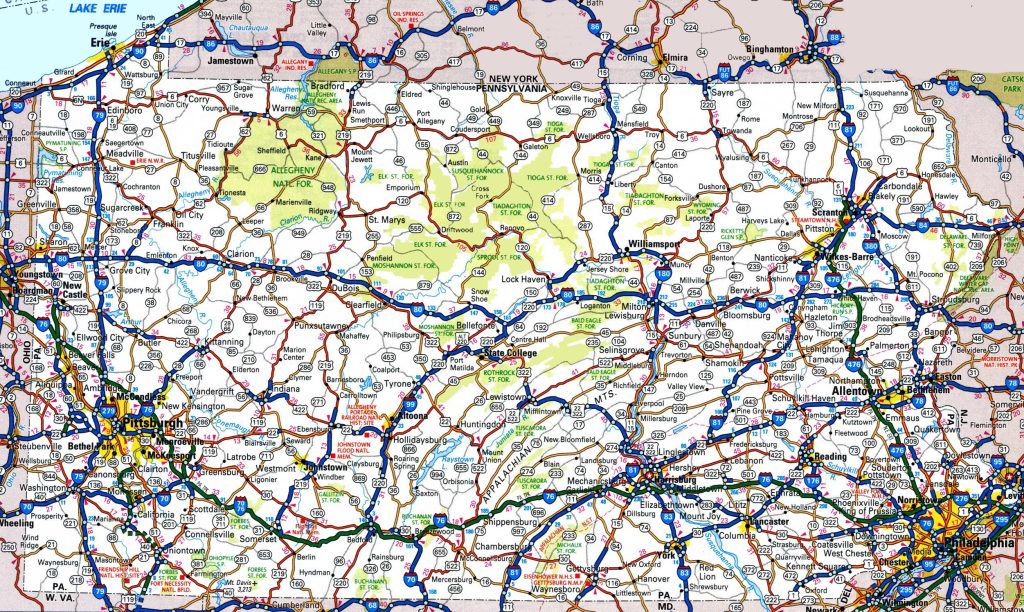
1. Pennsylvania Road Map:
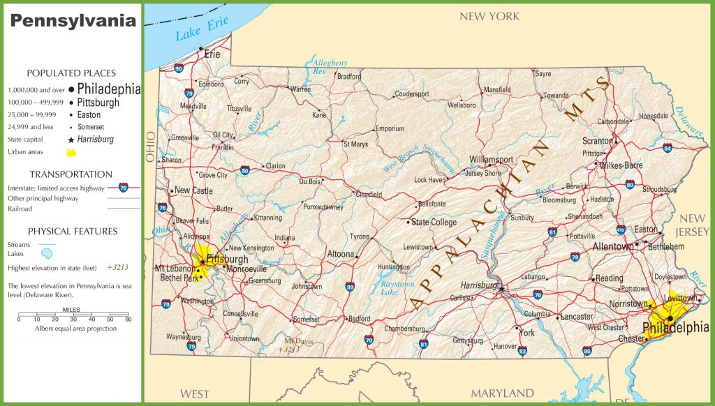
2. Pennsylvania Highway Map:
As you can see, there are two different types of maps that we have here. Each map contains some useful information.
The first map, titled “Pennsylvania Road Map,” contains all details of roads and their routes connecting other cities. You can easily navigate anywhere inside any city with the help of this map. This is a detailed map where you can find all the major roads of every city in this state.
The second map titled “Pennsylvania Highway Map” contains information about US highways, state routes, interstate highways, and US routes. A red line indicates the major US highways, and these highways also have a unique hwy number so you can easily identify any highway.
So, these were some important and useful road and highways maps that we have added above. All the maps are available in PDF format as well as in JPG format, and you can easily download any map by clicking on the buttons.