New York is the 11th state of the USA which is located in the North-eastern region of the country. This state is also known as the State of New York and New York state. Although, its nickname is The Empire State. And do not confuse New York City (NYC) and New York State (NY). Both are different. So, here on this page, we will provide information only about New York State. And, below we are adding some printable maps related to this state along with some useful information. So, let’s start with a map of New York state.
Collections of New York State Maps:
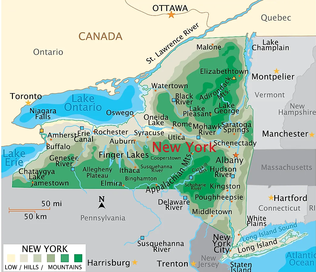
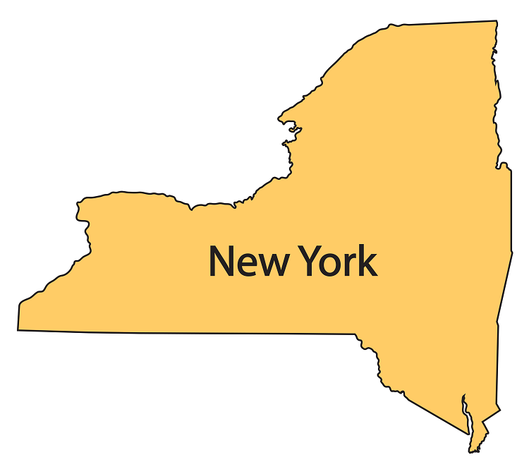
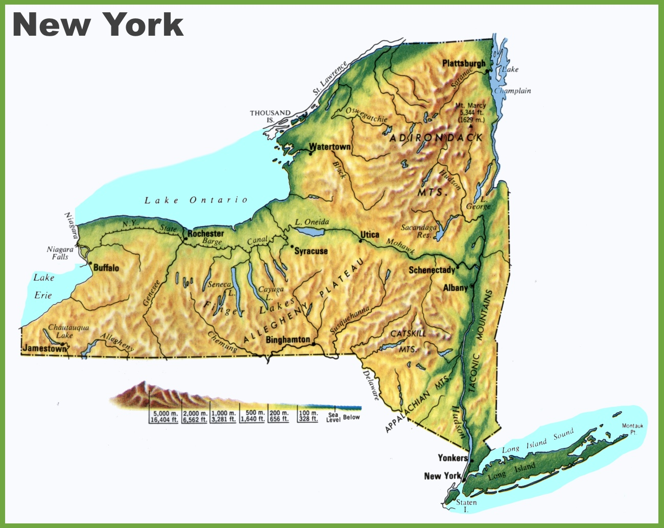
1. New York Map:
2. New York State Map with Cities:
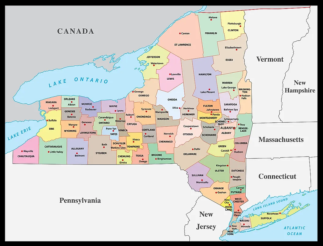
3. New York County Map:
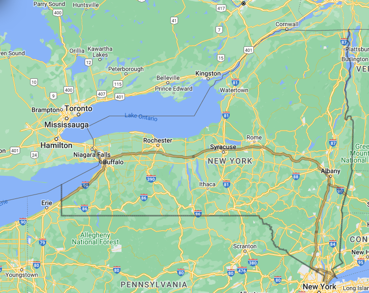
4. Google Map of New York:
5. Outline Map of New York:
6. Physical Map of New York:
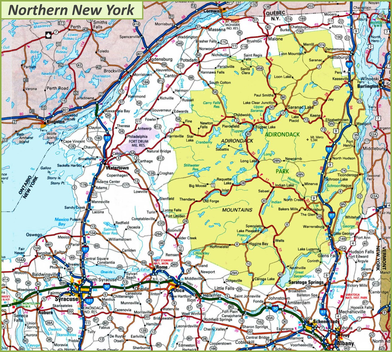
7. Map of Northern New York:
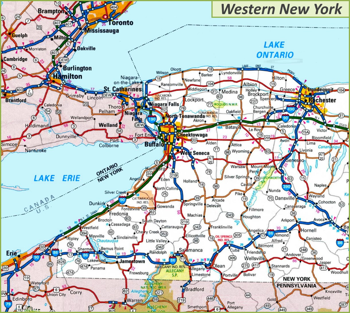
8. Map of Western New York:
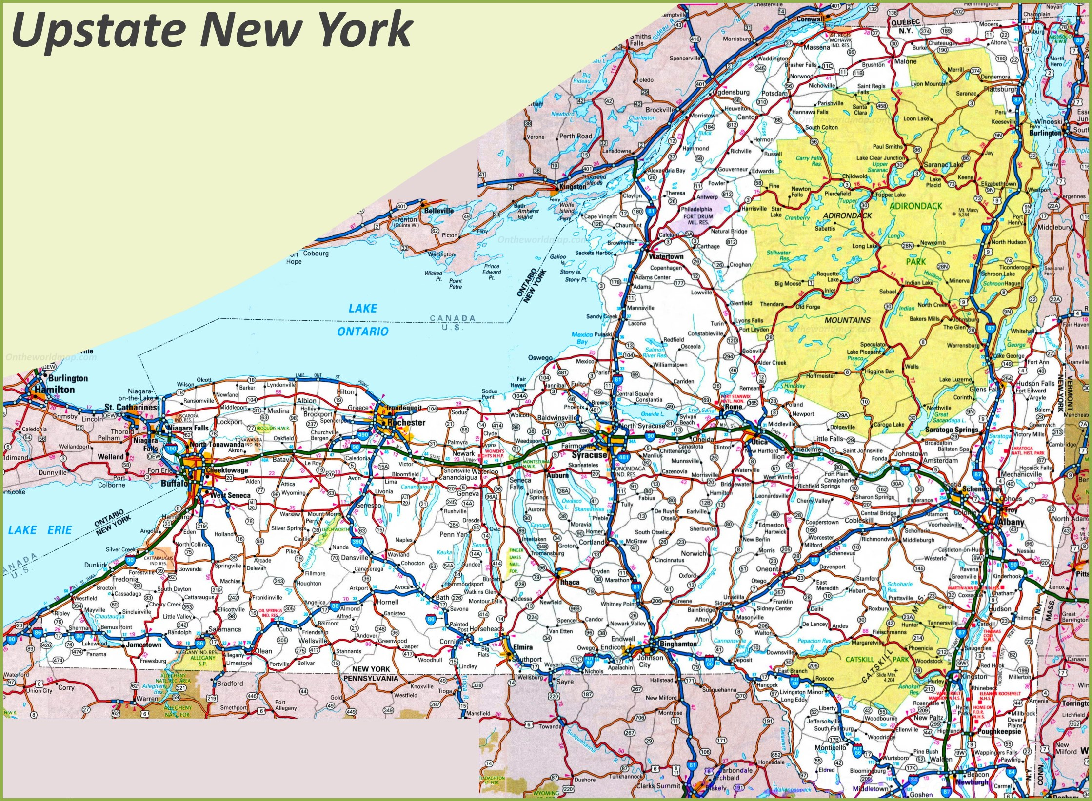
9. Upstate New York Map:
10. New York on World Map:
Here, we have added different types of New York state map. Each map contains some useful information. For you, we are adding some more useful information about each map here.
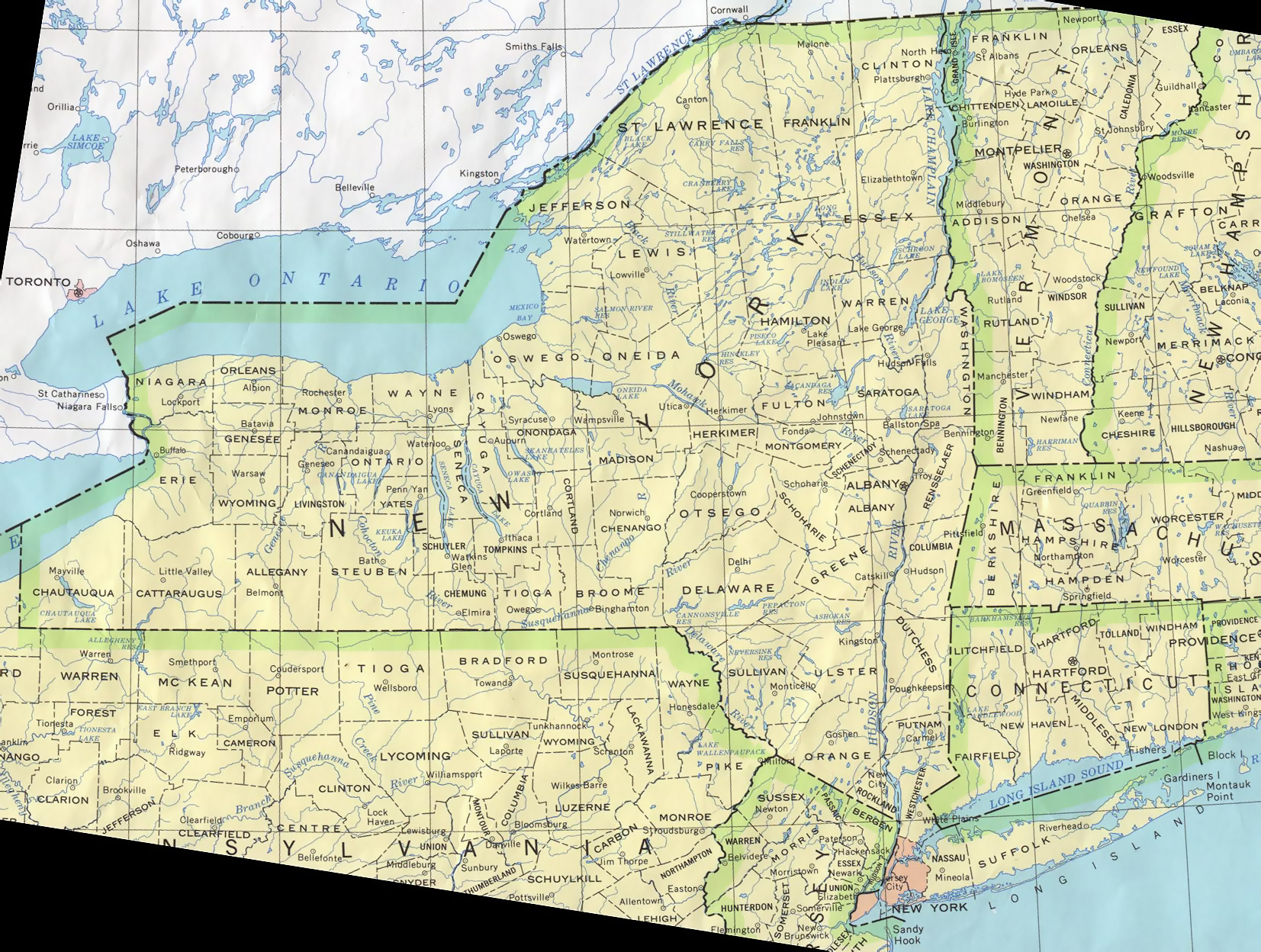
The first map is related to the detailed state map of New York, and this map shows some cities, counties, lakes, rivers, and mountains. You can easily locate a major place with the help of this map. The second map is a large and detailed map of New York with cities and towns. This map shows all cities, towns, roads, highways, railroads, airports, rivers, lakes, mountains, etc. The third map is related to the map of New York County. It is a full-detailed IL county map with cities. County seats are also shown on this map. The fourth map is titled “Google Map of New York.” This map is a Google map version of this state which shows some cities, towns, and the capital city of New York.
Now, the fifth map is a simple outline or blank map of New York, which shows the outer boundary. The sixth map is a physical image of this state. You will only see the outer boundary on this map. So, if you want a detailed map of this state, please check the first map. The next three maps are the specific area maps of New York, USA. On the seventh map, you will see all cities, towns, and roads of Northern New York, and on the eighth map, you will get to know all cities, towns, and roads of Western New York. The ninth map is related to Upstate New York. This is the geographic region of this state which is filled with beautiful nature and sub-urban cities. All three maps are the regional maps of New York state.
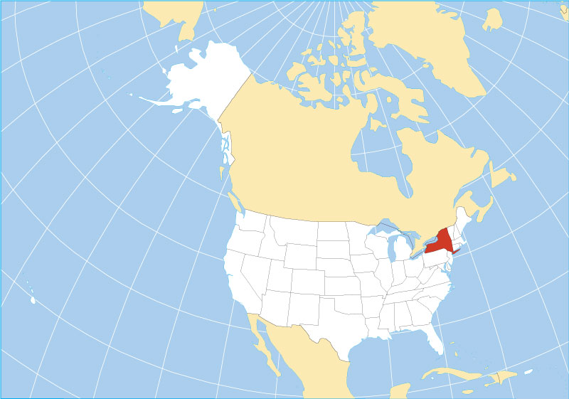
The last map shows the location of New York on the world Map. As you can see on the map, the area filled with red color indicates its location. So, these were some best and most useful NY state maps that we have added above. All the maps are available in PDF format and JPG format. You can easily download any map by clicking on the buttons under the preview image. All these maps are free to download.