New Hampshire is also known as “The Granite State” or “The White Mountain State” is a beautiful state of the United States of America which is located in the New England region. The New Hampshire Department of Transportation (NHDOT) is a U.S. Government agency that manages the roads and highways of New Hampshire and its cities. If you want to explore more about the NH roads and highways, check the New Hampshire Road Map and interstate highway maps. Please scroll down the page and have a look at these maps.
New Hampshire Road and Highway Map Collection:
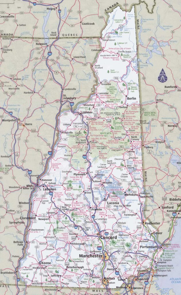
1. New Hampshire Road Map:
2. Road Map of South New Hampshire:

3. Road Map of North New Hampshire:

4. New Hampshire Highway Map:

These were some free New Hampshire (NH) road maps and highway maps in high quality that we have added. These maps have shown the useful information you need while travelling, or you can also use these maps for your college or school project and for any educational purpose.
List of Interstate Highways in New Hampshire State:
| Number | Length (mi) | Length (km) |
| I-89 | 60.864 | 97.951 |
| I-93 | 131.764 | 212.054 |
| I-95 | 16.193 | 26.06 |
| I-293 | 11.771 | 18.944 |
| I-393 | 4.594 | 7.393 |
List of U.S. Route in New Hampshire State:
| Number | Length (mi) | Length (km) |
| US 1 | 17.044 | 27.43 |
| US 2 | 35.437 | 57.03 |
| US 3 | 241.953 | 389.386 |
| US 4 | 106.83 | 171.93 |
| US 202 | 95.27 | 153.322 |
| US 302 | 79.155 | 127.388 |
The first map, the “New Hampshire Road Map,” contains all the information about all the state’s roads. On this map, you will see also see all the cities roads. This map will show you all the roads that lead to different cities in this state. With the help of this map, you can easily navigate anywhere in this state.
The second and third maps are related to the specific region road map of New Hampshire. The second one is related to Southern New Hampshire and the third map is related to Northern New Hampshire. In these maps, you will get to know all details of the cities, their roads and their routes also. You can easily identify any location with the help of these maps and can navigate anywhere.
The last map, “New Hampshire Highway Map,” shows all information about the highways, interstate highways, and the roads that connect other major cities in this state. In this map, all major highways are marked with red lines. And, all the highway numbers are mentioned on this map, so you will easily identify and navigate anywhere.
These were some best road and highways maps that we have added above. All the maps are available in PDF format as well as in JPG (Image) format. You can easily download any map by clicking on the buttons that are under the preview image. And, these maps are available free for you.