The Roads and Highways of Nebraska are maintained by the Nebraska Department of Transportation (NDOT). This is USA based government agency that managed all activities of its roads and highways. If you want to explore more about the roads and also planning to travel in this state, you must have Nebraska Road Maps and Highway Maps. Here we have useful maps of Nebraska. Scroll down the page and have a look at these maps.
Nebraska Road and Highway Map Collection:
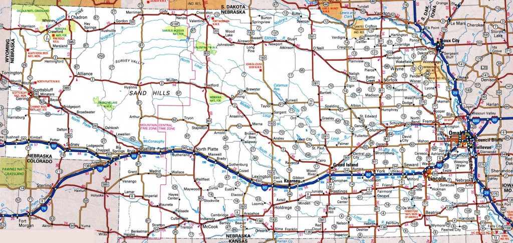
1. Nebraska Road Map:
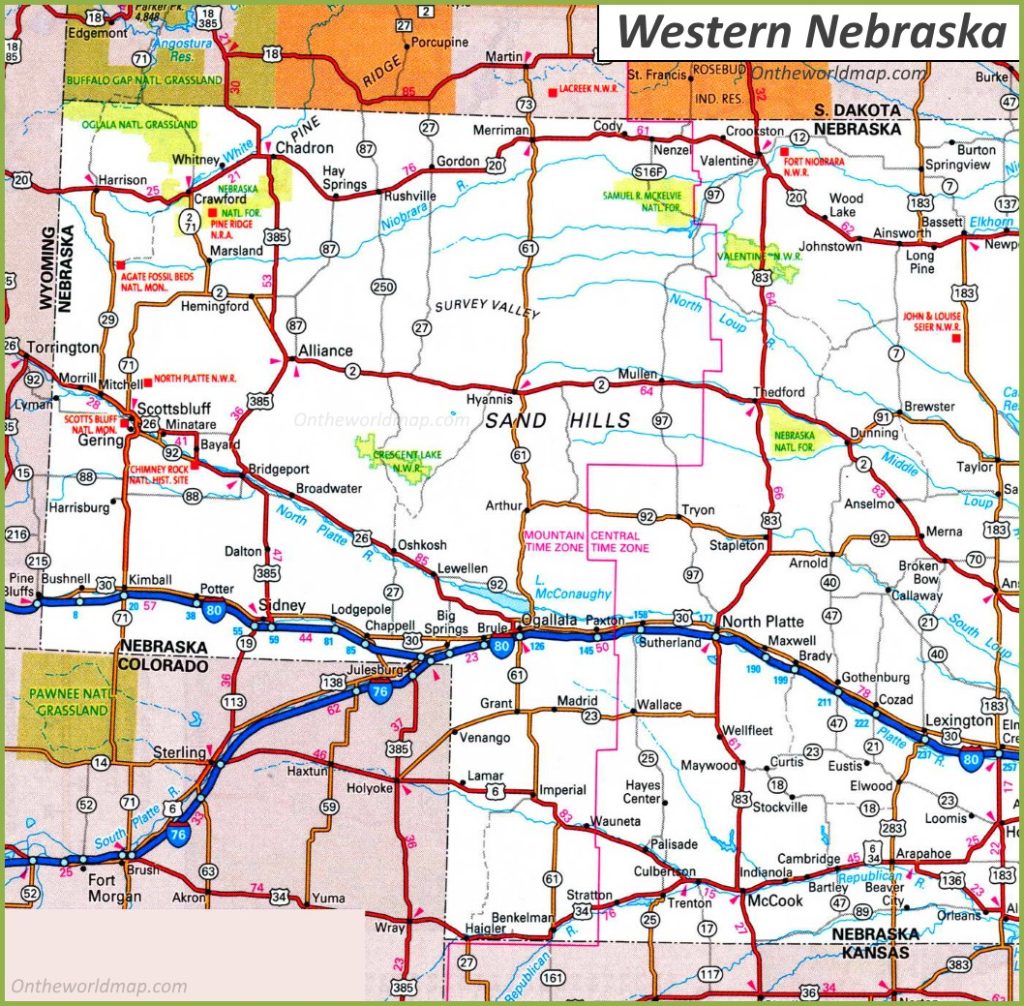
2. Road Map of West Nebraska:
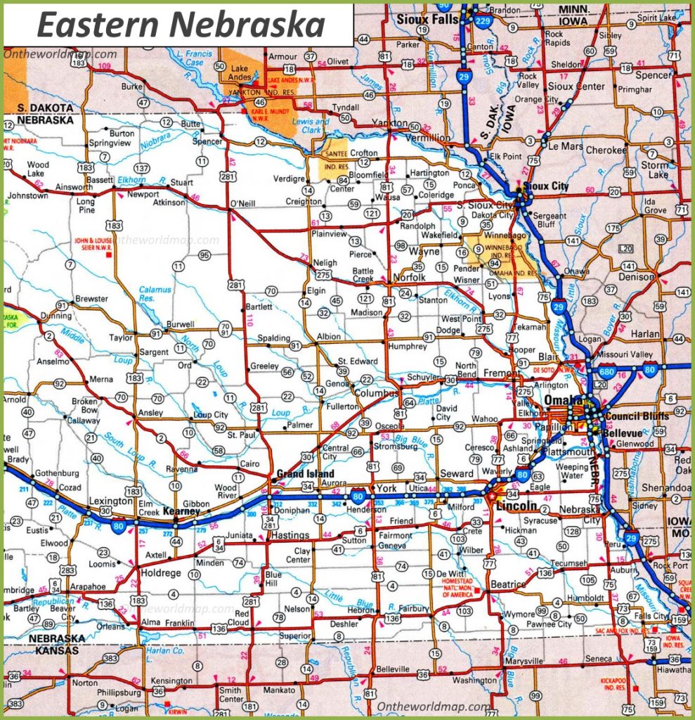
3. Road Map of East Nebraska:
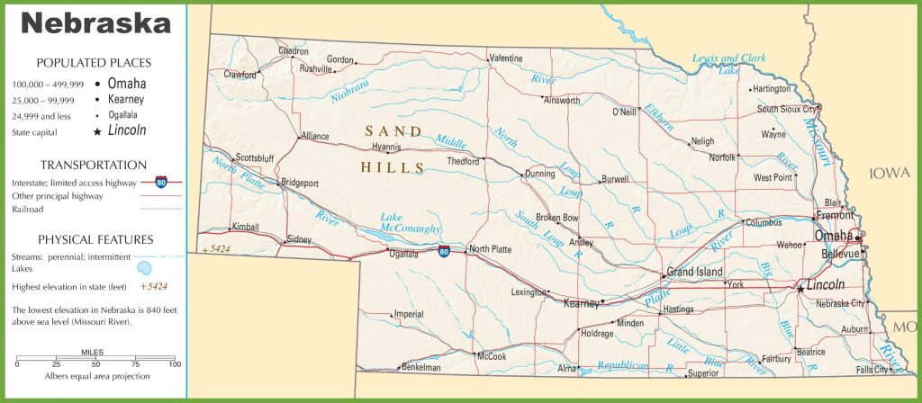
4. Nebraska Highway Map:
Above were some useful and free Nebraska (NE) road maps and highway maps in high quality that we have added above. Below we are describing some brief descriptions of each map that is shown above.
List of Interstate Highways in Nebraska:
| Number | Length (mi) | Length (km) |
| I-76 | 3.15 | 5.07 |
| I-80 | 455.32 | 732.77 |
| I-129 | 3.21 | 5.17 |
| I-180 | 3.47 | 5.58 |
| I-480 | 4.15 | 6.68 |
| I-680 | 13.32 | 21.44 |
List of US Highways in Nebraska:
| Number | Length (mi) | Length (km) |
| US 6 | 372.88 | 600.09 |
| US 20 | 428.39 | 689.43 |
| US 26 | 150.79 | 242.67 |
| US 30 | 451.74 | 727.01 |
| US 34 | 387.83 | 624.15 |
| US 73 | 97.71 | 157.25 |
| US 75 | 184.72 | 297.28 |
| US 77 | 189.88 | 305.58 |
| US 81 | 216.69 | 348.73 |
| US 83 | 222.79 | 358.55 |
| US 136 | 239.88 | 386.05 |
| US 138 | 11.47 | 18.46 |
| US 159 | 13.86 | 22.31 |
| US 183 | 225.91 | 363.57 |
| US 275 | 190.82 | 307.1 |
| US 281 | 222.78 | 358.53 |
| US 283 | 58.44 | 94.05 |
| US 385 | 180.36 | 290.26 |
The first map, “Nebraska Road Map,” contains details of roads and their routes that connect all other cities of Nebraska State. You can easily identify any direction and navigate anywhere inside any city. The second and third maps are related to specific area or region maps. These maps are showing all cities roads, highways and street roads of these areas. These maps will help you a lot in your travel.
The last map is related to Nebraska Highways Map. This map shows all the major highways, interstate highways, and U.S highways. The thick red line shows the major highways of Nebraska State. You can easily find the best route to any city with the help of this map.
So, these were some important and useful road and highways maps that we have added above. All the maps are available in PDF format as well as in Image format. You can easily download any map by clicking on the buttons under the preview image of a particular map.