California or the State of California is a state in the Western region of the country located along the Pacific Coast. This state is admitted to the union on 9th September 1850. CA, USA becomes the 31st state of the United States of America. California also has a nickname which is: The Golden State. Its capital city is Sacramento.
You may explore more about this state with the help of a map of California because on this page we are adding some useful and interactive maps related to California State. So, scroll down the page and check our collection of different maps related to the state of California.
Collections of California State Maps:
1. California Map:
2. CA Map (Type – 2):
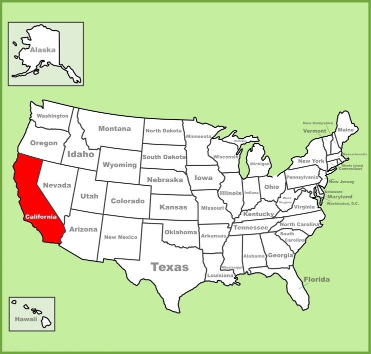
3. California on USA Map:
4. California on World Map:

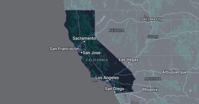
5. Google Map of California:
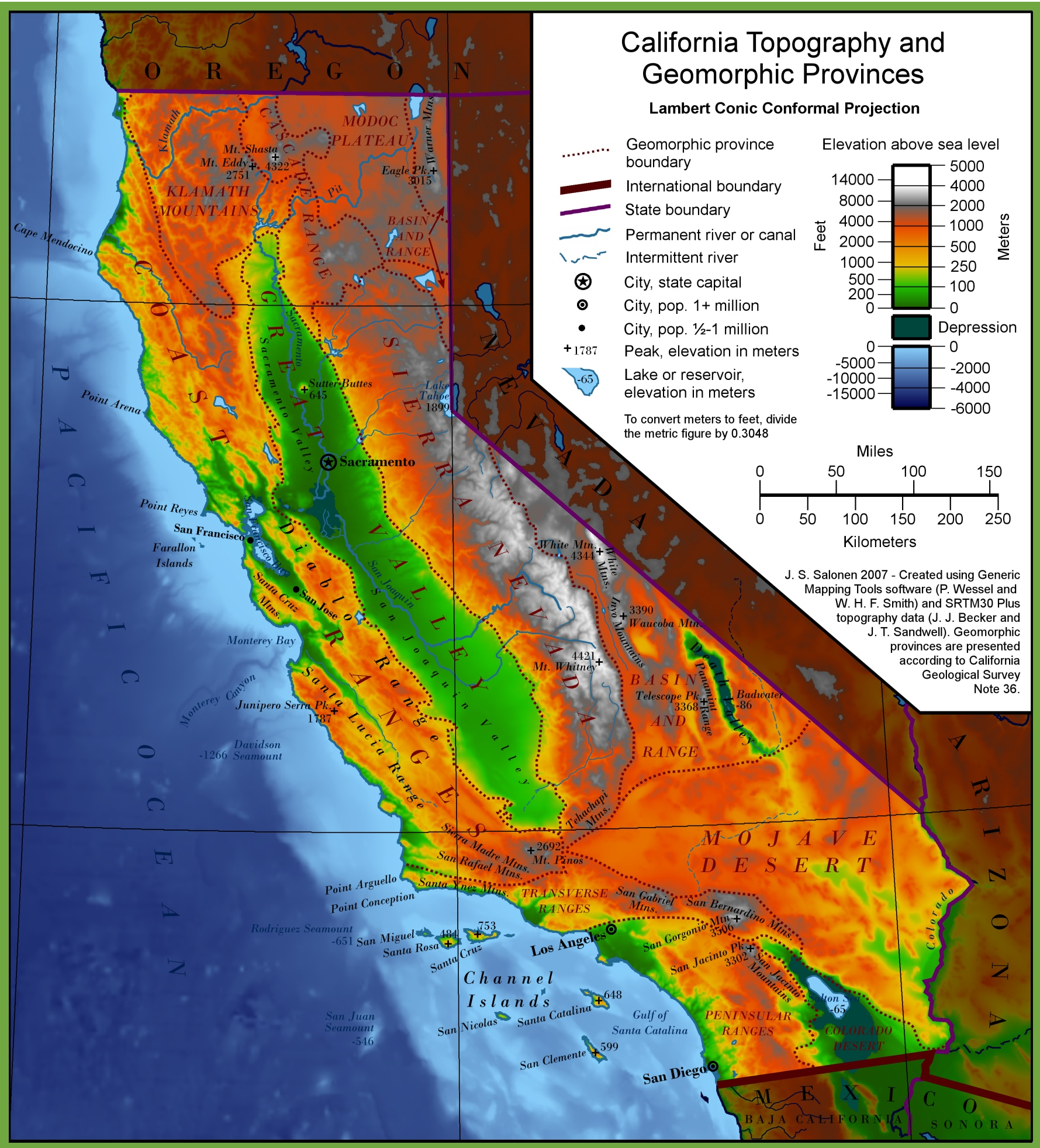
6. Topographic Map of California:
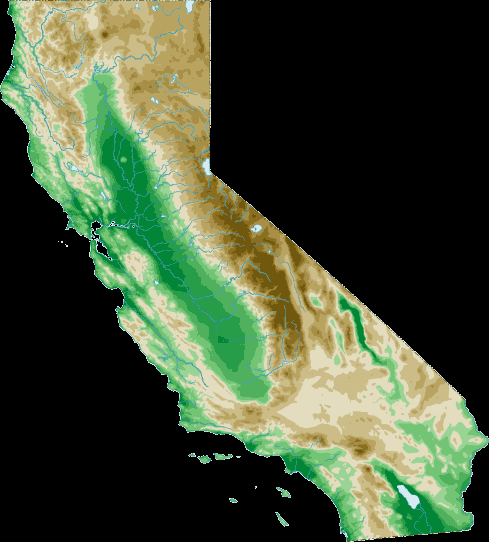
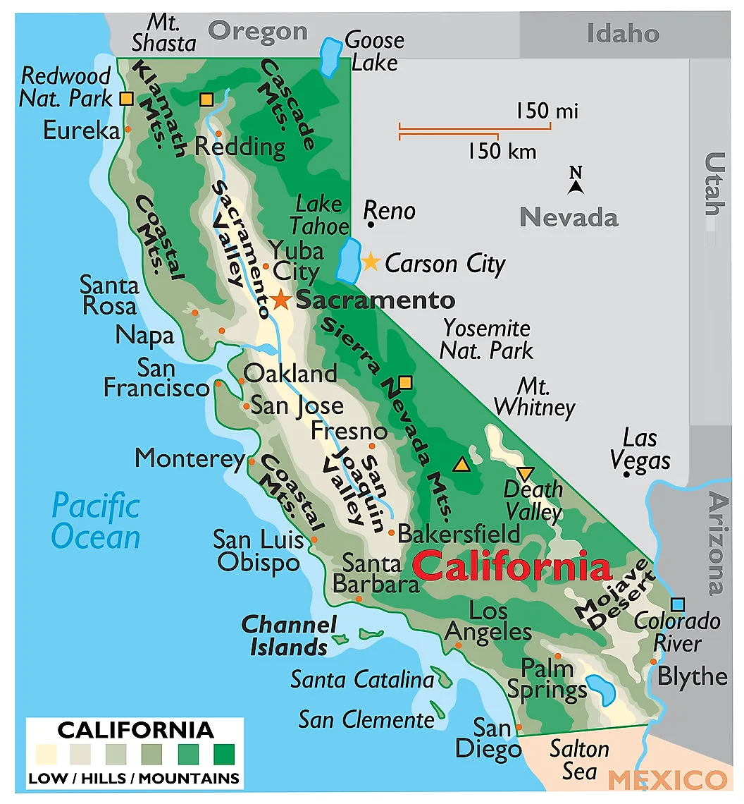
7. Physical Map of California:
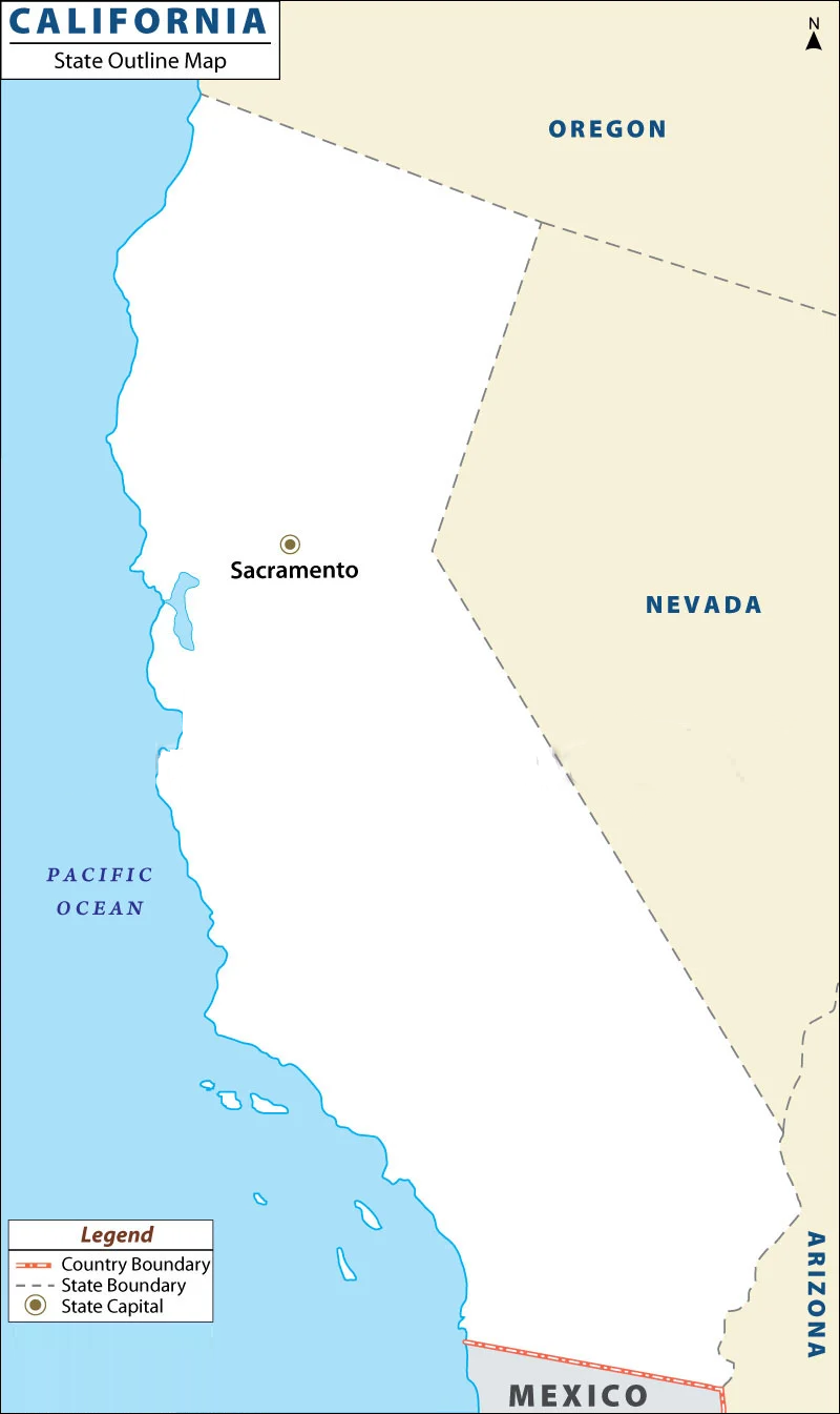
8. Outline Map of California:
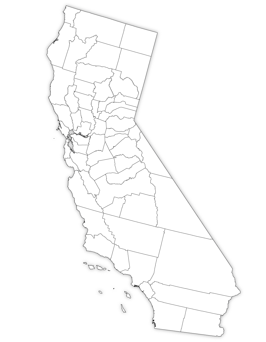
9. Blank Map of California:
10. Map of Southern California:

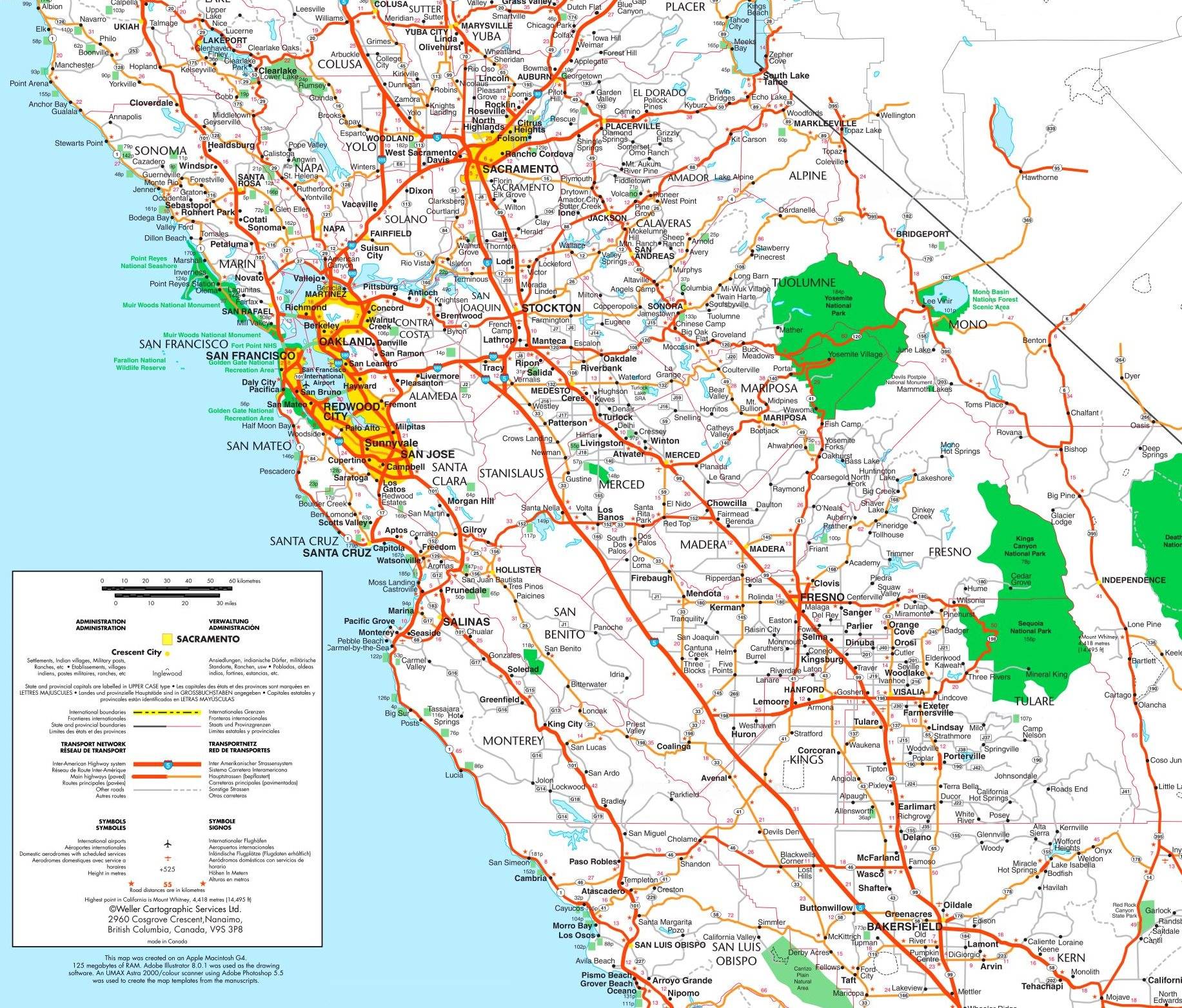
11. Map of Central California:
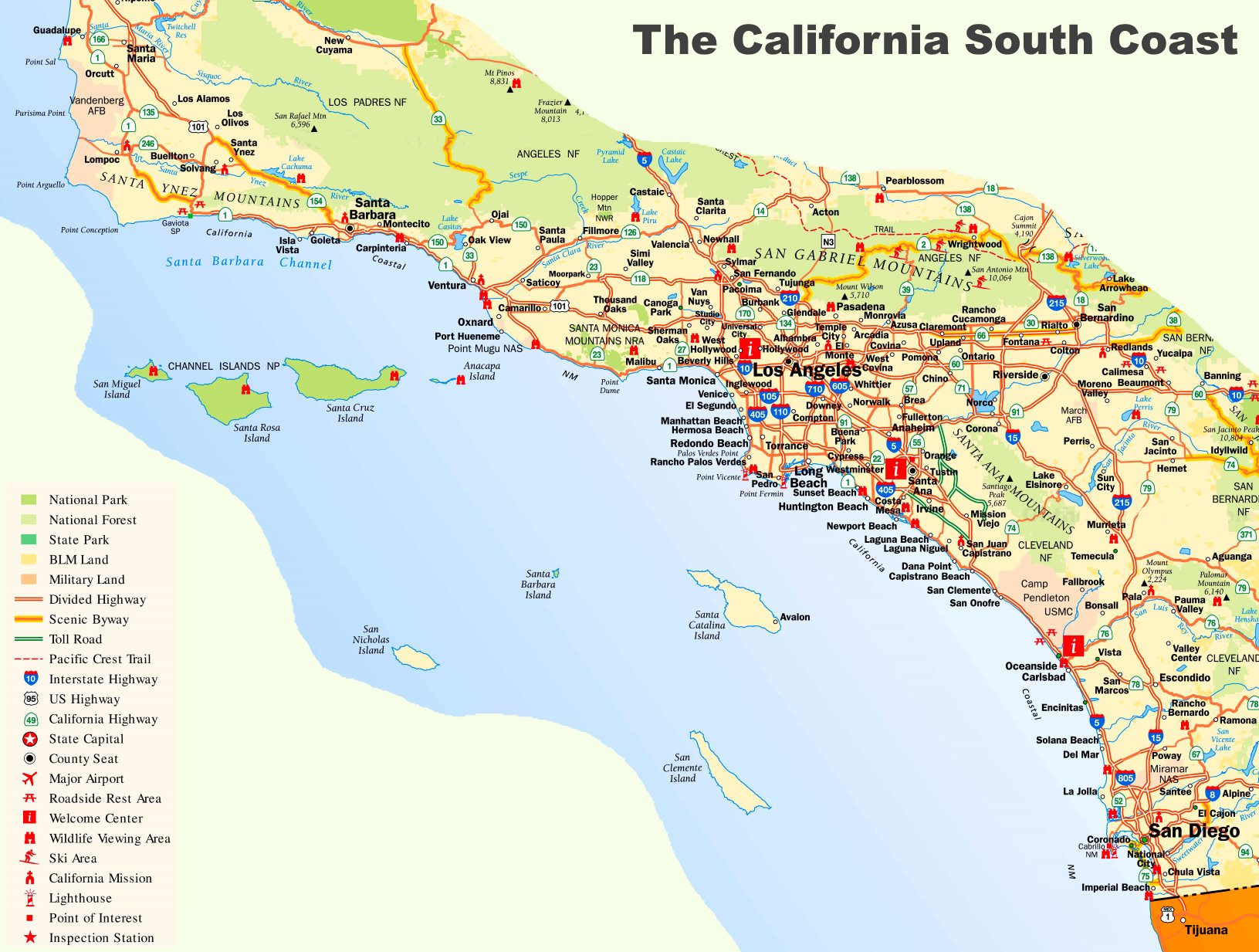
12. California South Coast Map:
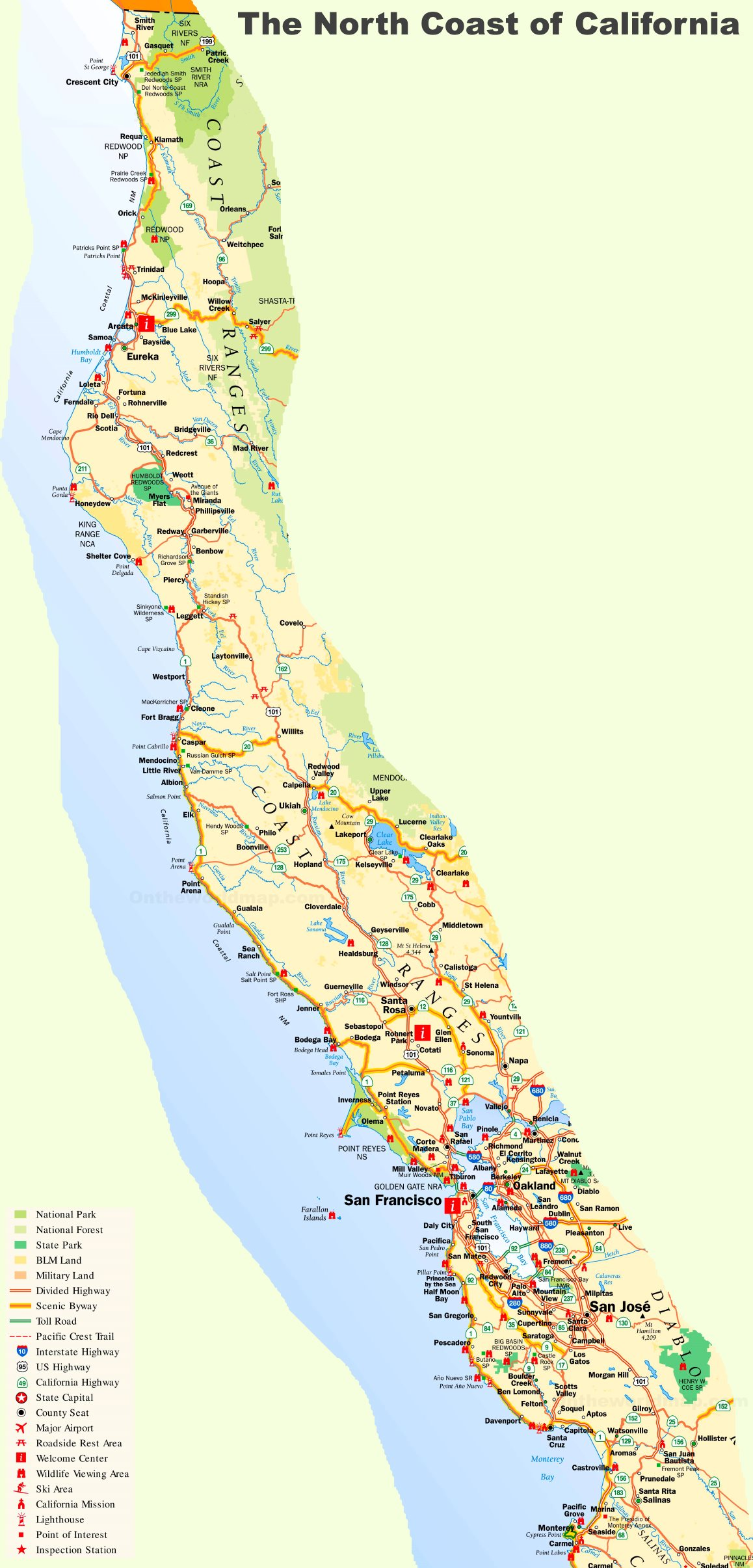
13. California North Coast Map:
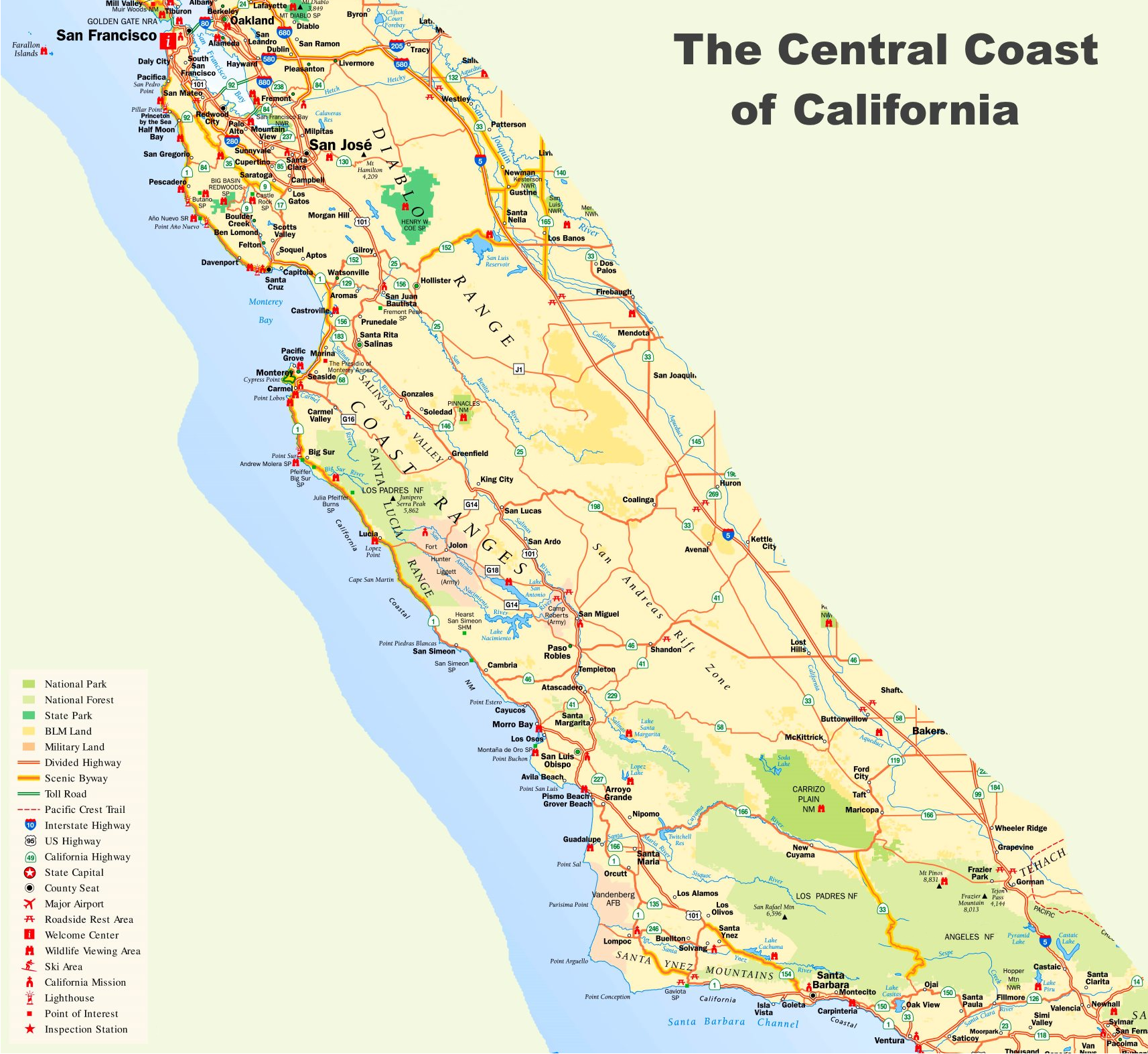
14. California Central Coast Map:
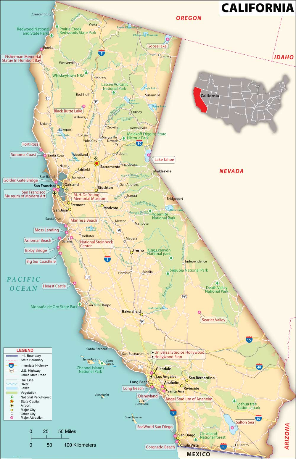
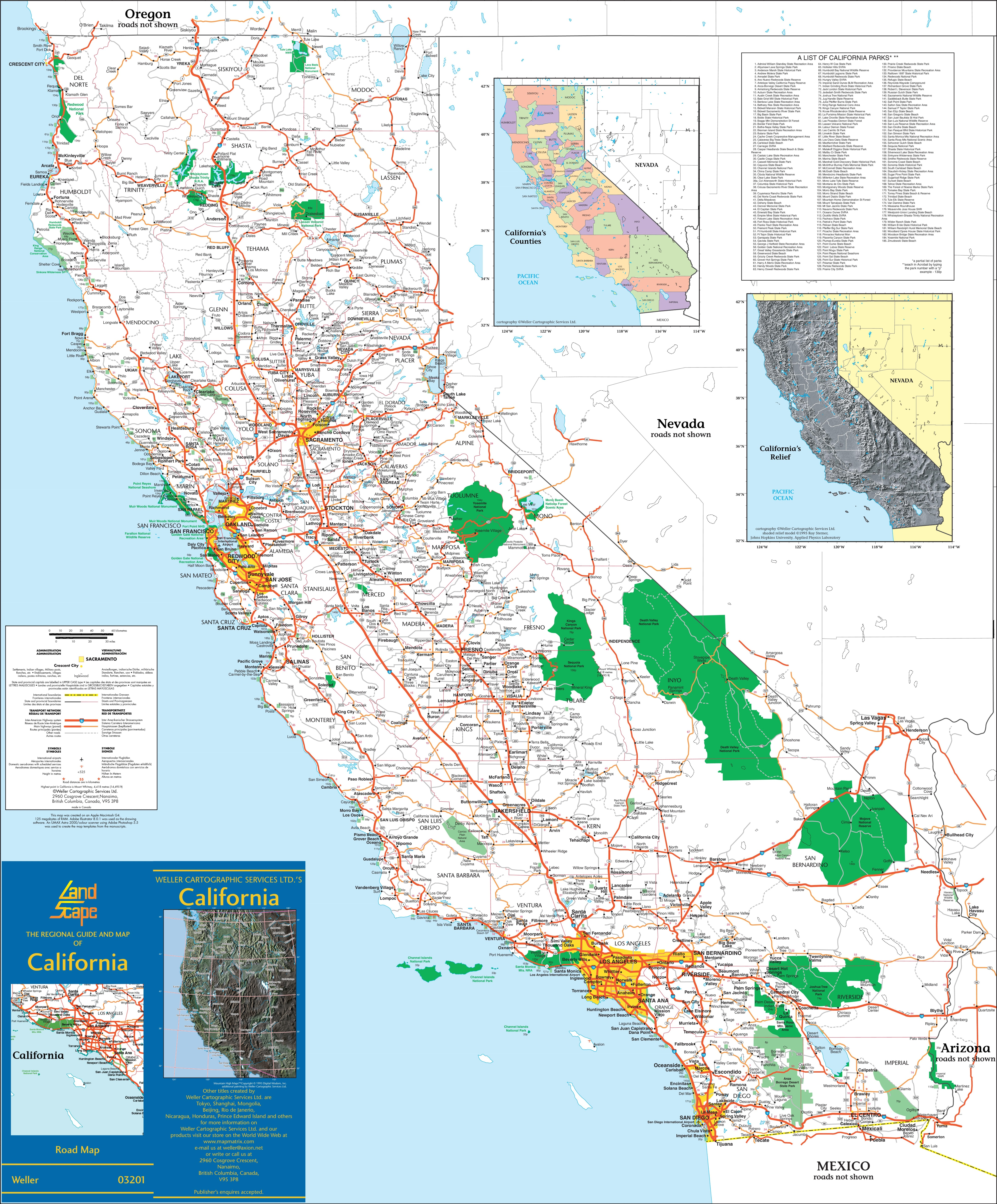
15. California Map with Cities & Towns:
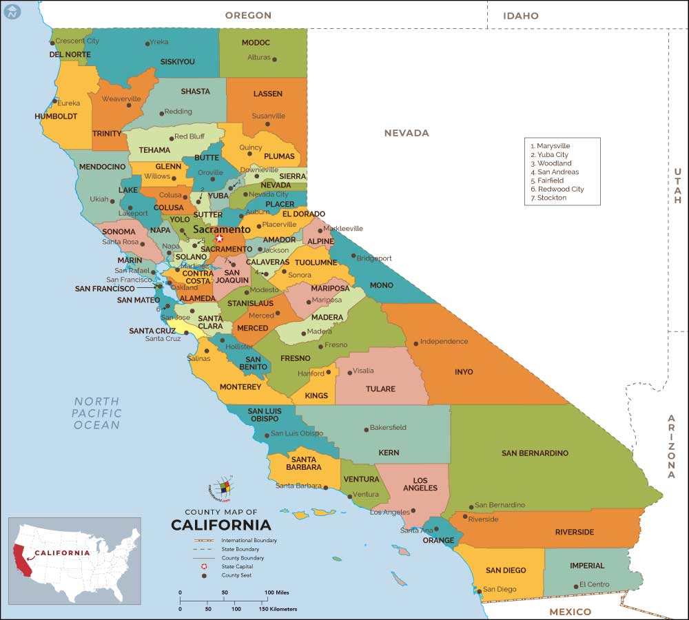
16. California County Map:
17. Map of Northern California:

Here, we have added seventeen different types of collections of California state map. Each map contains some useful information. For you, we are adding some more useful information about each map here.
The first map is related to the main state map of California, and this map shows some cities, counties, lakes, rivers, and mountain ranges. You can easily locate a major location with the help of this map. The second map is also related to California state, and it is a fully detailed state of California. The third map shows the location of California on the USA Map. As you can see on the map, the area filled with red color indicates the location of this state on the country map. The following map is also showing California’s location on the world map, as you can see that an arrow in red color points to California state.
If you are looking for some other maps related to California then visit the link that we are providing below.
- California Road Maps
- California River Maps
- California Mountains Ranges Maps
- California Highway Maps
- Printable Maps of California
The fifth map is titled “Google Map of California.” This map is a type of Google earth map version of this state which shows some cities, towns, and the capital city of California. The next map is a topographic map of California, that shows all county lines. The seventh map is a physical map of California which shows all the useful information that you need. Now, the eighth map is a simple outline map of California, which shows the outer boundary of this state. This map only shows the structure of this state. The ninth map is a blank map of California which all inner and outer boundaries. This map shows the structure of all counties.
The next two maps are the regional maps of California, USA. On the tenth map, you will see all cities, towns, and roads of Southern California, and on the eleventh map, you will get to know all cities, towns, and roads of central California. Now, the next three maps show all coastal areas of California. The twelfth map shows California’s South Coast and the next map shows all cities and towns of the North Coast of California and the following map is related to the Central Coast of California. On this map, you will see all counties, towns, cities, and other places in this region.
The fifteenth map is a large and detailed map of California with cities and towns. This map shows all cities, towns, roads, highways, railroads, airports, rivers, lakes, mountains, etc. The sixteenth map is related to the map of California county. It is a full-detailed county map with cities. County seats are also shown on this map.
And the last map is also a regional map of California state which is related to Northern California. So, these were some best and most useful California maps that we have added above. All the maps are available in PDF format and JPG format. You can easily download any map by clicking on the buttons under the preview image. All these maps are free to download.