Vermont has 237 towns, 09 cities and 14 counties. And, here on this page we are adding some useful and printable maps of Vermont cities and towns. These maps are very interactive and help you to explore more about the cities, towns and counties of Vermont. So, please scroll down the page and let’s start with the map of Vermont towns. And, if you’re looking for a full detailed map of Vermont state then you should click this link.
Maps of Vermont State with Cities and Towns:
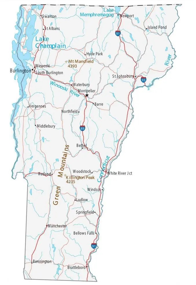
1. Map of Vermont Towns:
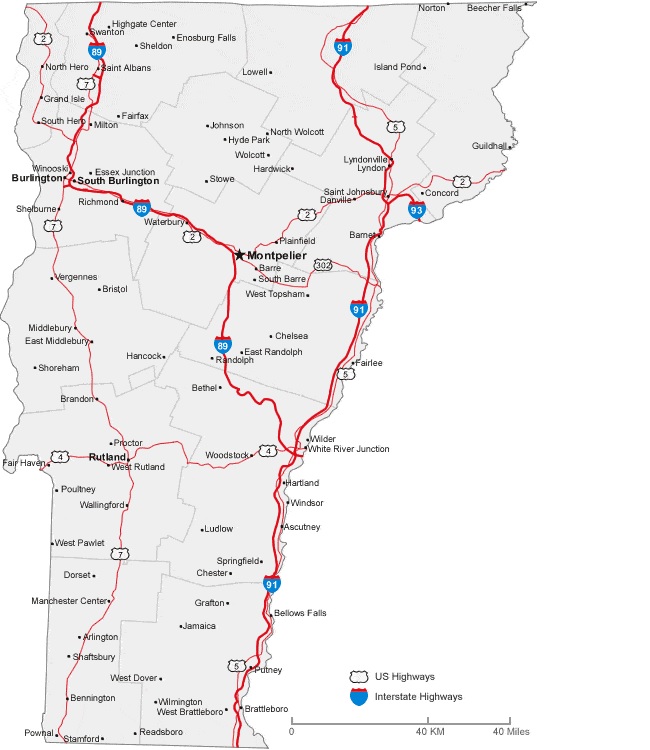
2. Vermont Map with Cities:
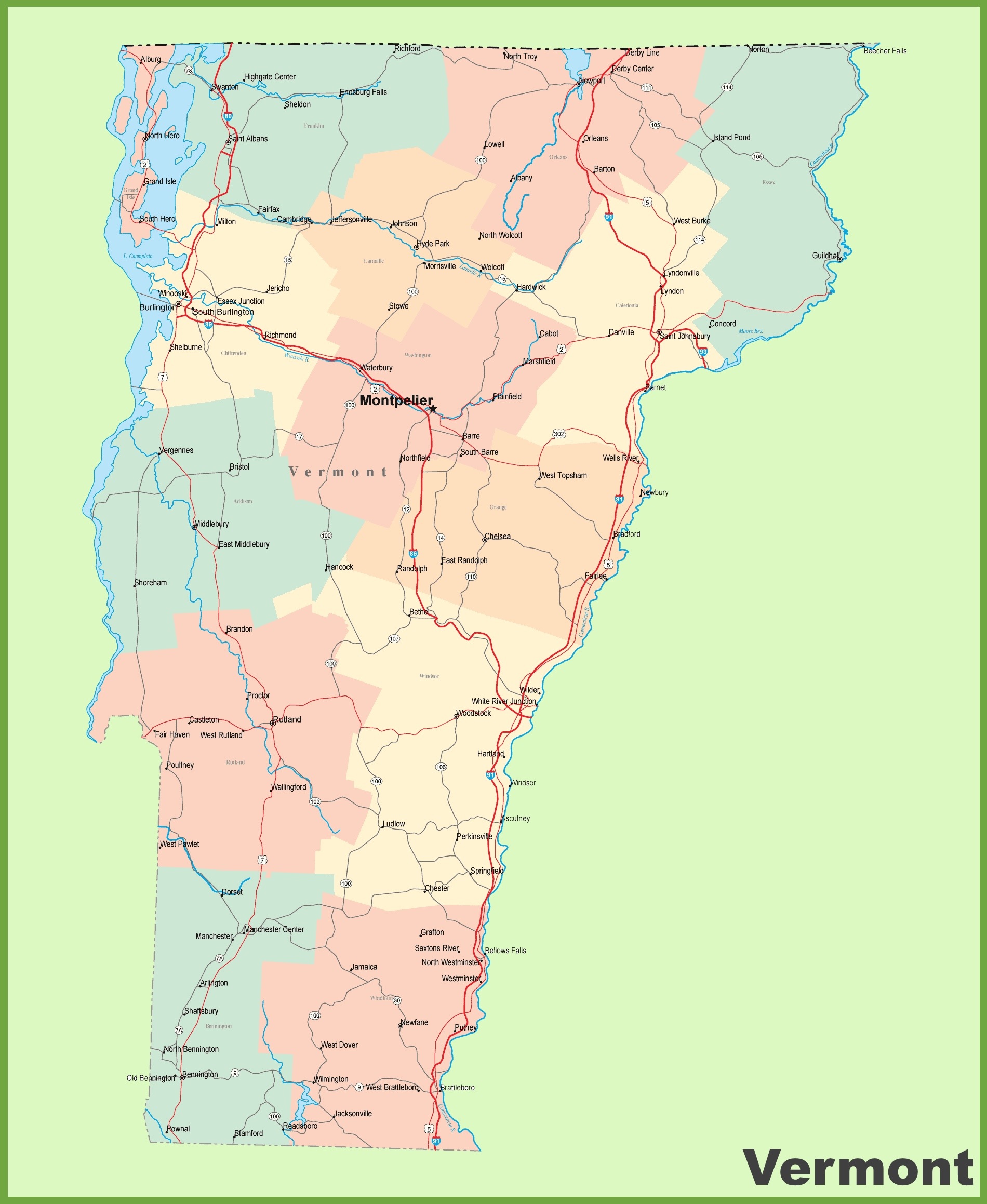
3. Map of Vermont Cities and Towns
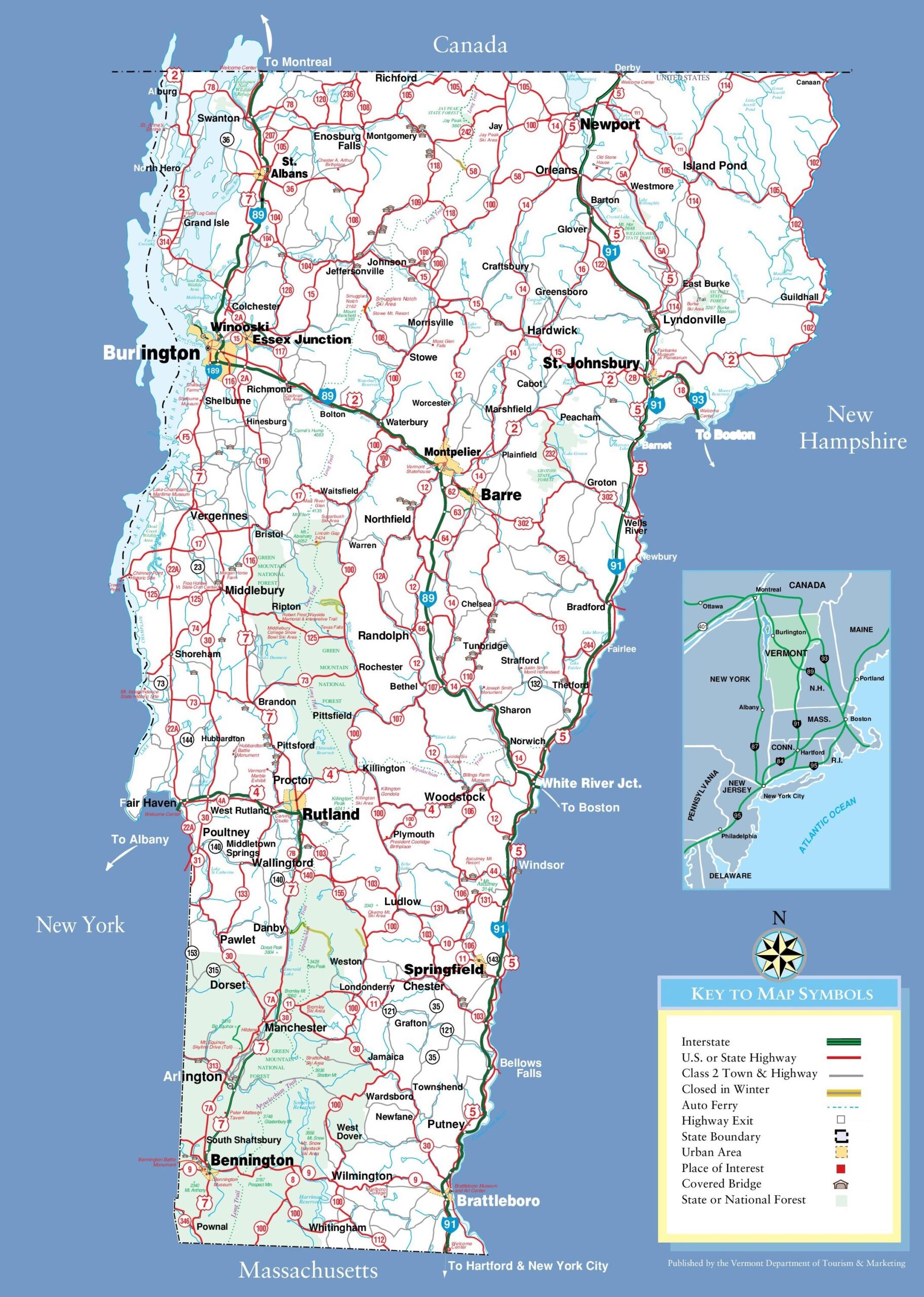
4. Map of Vermont with Cities and Towns (Detailed):
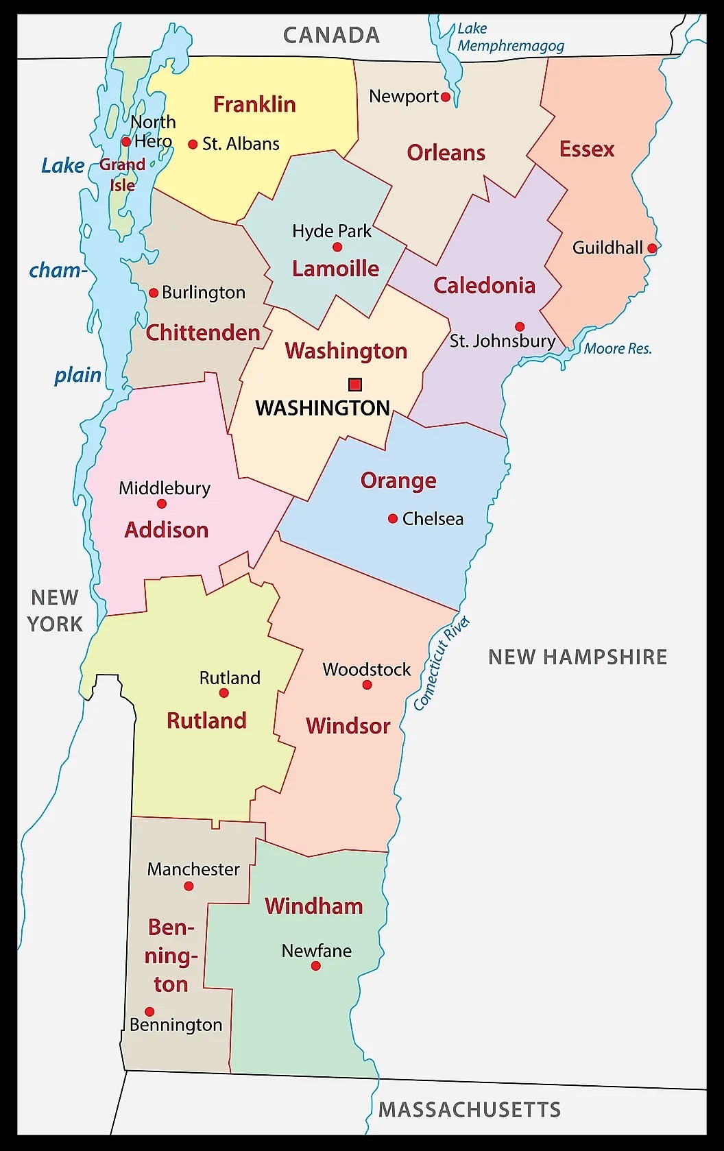
5. Map of Vermont with Counties:
6. Map of Vermont:

Above we have added some map of Vermont with cities and towns, county map of Vermont and a map of Vermont state. These maps are high in resolution so you can easily save or print any map for free. Below, we are also describing each map so read the description before view and downloading any map in your device.
The first map is related to the main town map of Vermont. This map shows all towns of this state, so you can easily locate any town. Now, the second map is about the Vermont map with Cities. On this map, you will see all cities of this state. In both maps, roads are also visible to find any route with the help of these maps. When you check the third map, this is also of map of Vermont Cities and Towns. This map shows all counties, all cities and towns. This map also contains all city roads, major street roads, interstate highways, U.S. routes. So, you can easily navigate anywhere with the help of this map.
Now, the fourth map is also about the map of Vermont Cities and Towns, this is a detailed map. Because this map shows all counties, cities, towns, and all city roads, street roads, national highways, interstate highways, and other major roads, this map also shows all lakes, rivers, and other major water bodies. The fifth map is a printable County map of Vermont. This is a full version of Vermont Counties. All major cities, towns, and other important places are visible on this map. And, last map is about VT map. This is the main state map of Vermont. So, these were some maps of Vermont Cities and Towns. All these maps are free to download. All the maps are available in PDF and JPG (Image) formats. You can easily download any map by clicking on the buttons under the preview image.