Mississippi is the 31st largest state in the country based on area that spanning in the total area of 48,130 sq. miles and 32nd most populous state (with 2,949,965 inhabitants) of the USA which is located in the south-eastern region of the country. Mississippi is divided into 433 municipalities which included all cities, counties and towns. Here, on this page we are adding some useful information about all cities and towns along with a Mississippi map with cities and towns. So, scroll down the page and check our collection of map of Mississippi with cities.
Maps Collection of Mississippi (MS) Cities and Towns:
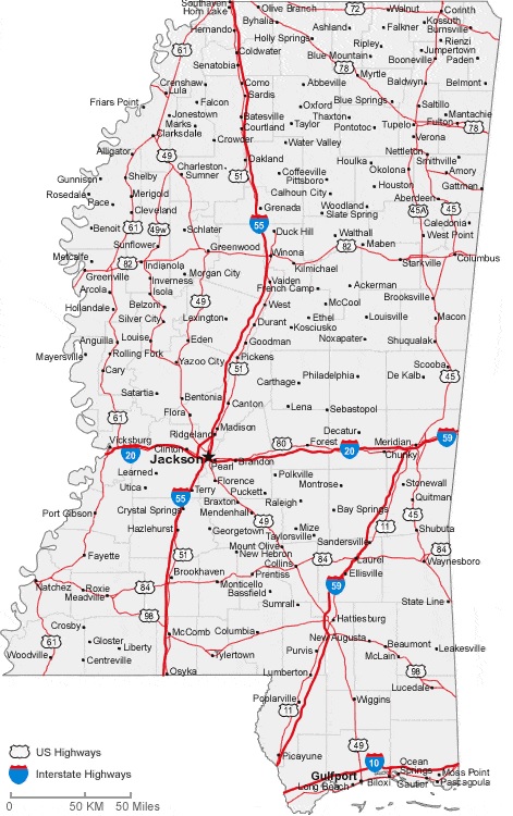
1. Map of Mississippi with Cities:
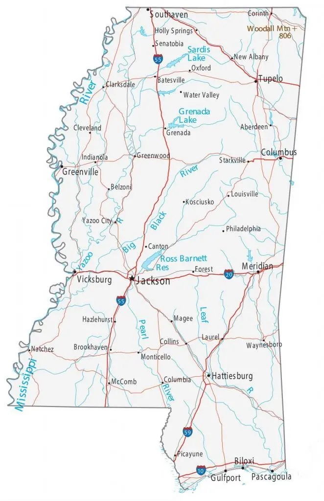
2. Map of Mississippi Towns:
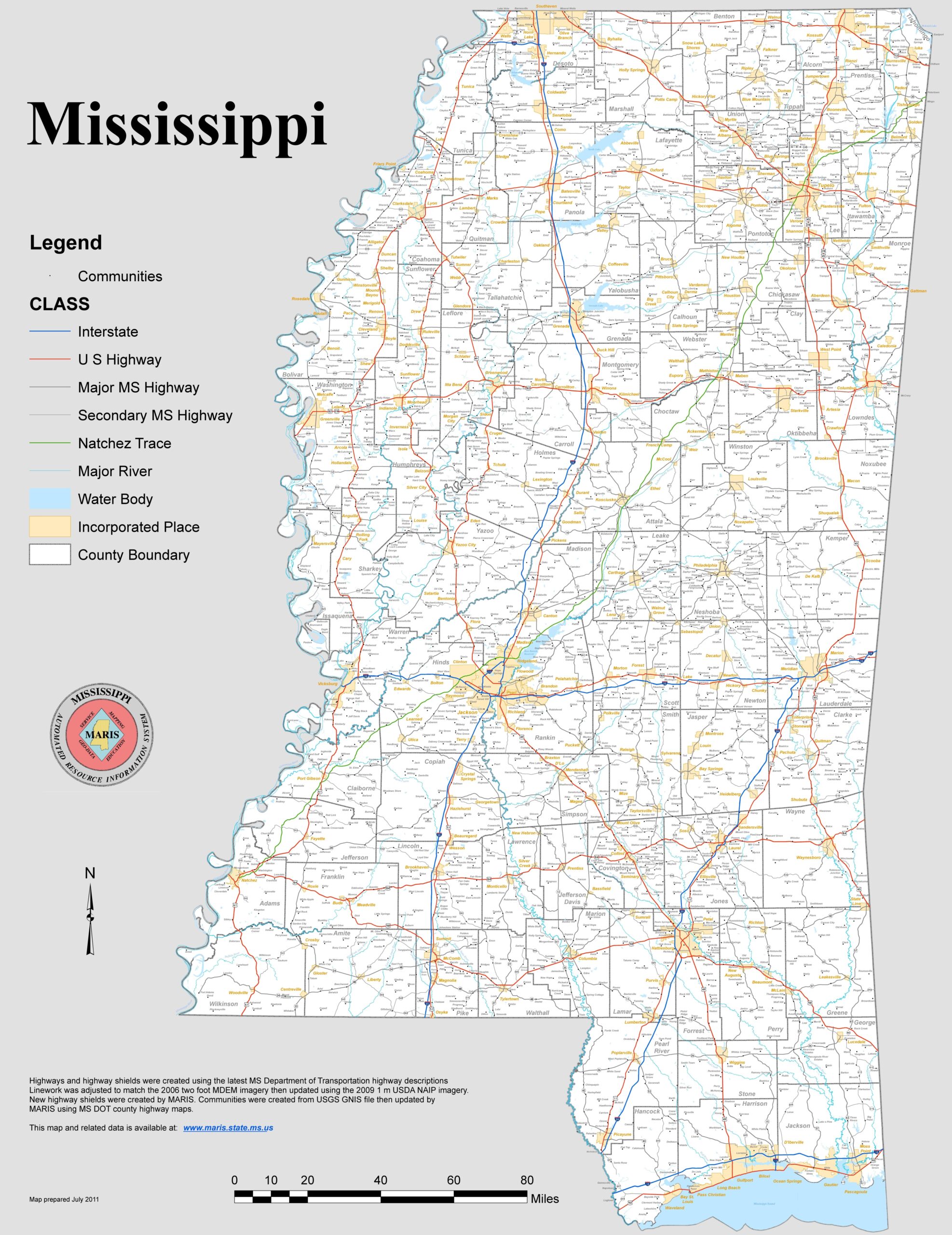
3. Mississippi Map with Cities and Towns:
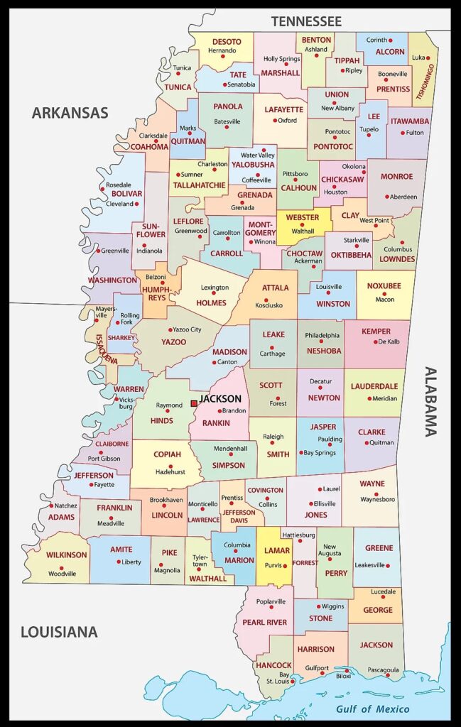
4. MS County Map:
5. Mississippi Map:
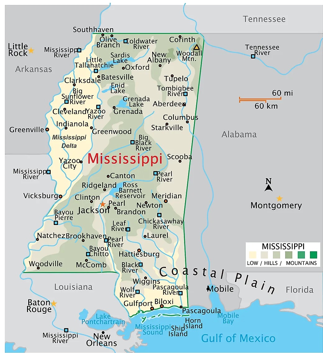
This is the collection of map of West Mississippi Cities and Towns that we have added above. We have added five different maps that contain some helpful information. Below, we are also adding some brief information about each map. So, please read the full description of each map.
The first map is about the city map of Mississippi state, and this map shows all cities. You can locate any city on this map. This map also shows all counties. The second is related to the Town map of this state. As you can see on the map, all major towns are visible, along with some interstate highways. A thick red line indicates all interstate highways of this state. The third map is a large and detailed Map of Mississippi Cities and Towns, shows all the cities, towns, counties, other significant places and tourist places. And on this map, you can also know about all parks, malls, beaches, airports, railroads, street roads, city roads, interstate highways, and other states’ highways.
The fourth map is related to Mississippi county map. You can easily identify any county with the help of this map. The fifth map is related to the main state map of this state, which shows all counties and major cities on the map. This map also shows national highways, major roads, water bodies, railway network, the state capital, and major towns. So, these were some large and printable Mississippi Cities & Towns maps that we have added above. All these high-quality maps are available in PDF format and JPG (Image) format. Download any map for free.