Hawaii has 153 cities and towns that covers an area of 10,931 square miles (including 6,423 sq miles of land and 4,507 sq miles of water). Largest city and capital of this state is Honolulu. Hawaii have 47th rank in the country based on land area. You can learn more about Hawaii with the help of our collection of cities and town maps of this state. So, for this you have to scroll down the page and check all printable maps. Now, let’s start with the map of Hawaii with Cities along with a county and its state map.
Collection of Cities and Towns Maps of Hawaii State:
1. Map of Hawaii with Cities:
2. Map of Hawaii with Towns:

3. County Map of Hawaii:

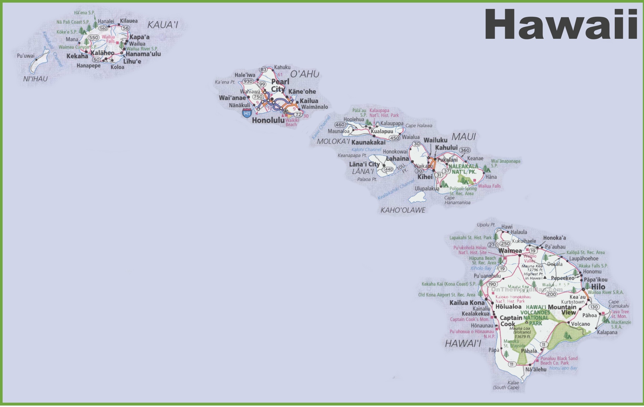
4. Map of Hawaii:

Above, we have added maps related to the cities and towns of the Hawaiian state. Below, we’re also giving some information about each map, so read the information and get any map on your device for free.
The first map is related to the major cities of Hawaii state. So, you can quickly locate any city in Hawaii with the help of this map. Now, on the following map, you will get to know about the towns of Hawaii State. In this map, some major state roads and highways are also visible. But for more detailed information, you can also check some other Roads and Highway Maps of Hawaii State. Please click this link for such maps and information.
The third map is related to the main County map of Hawaii. In this map, you can easily locate any county in this state. The county seat and major cities are also mentioned on this map. The fourth map is related to the complete state map of Hawaii with towns, cities, roads and highways.
So, these were some best printable Town and City maps of Hawaii state or The Big Island State. You can easily print any map because all maps are HD quality and available in PDF and JPG format. And you can download any map for free by clicking on the buttons under the preview image.