California is a most populous state located in the Western United States. It is also the third largest state by area of the country. California is divided into 482 municipalities that have approx. 1578 cities and towns. And, in those cities, towns, and villages – there are approx. 39,185,605 inhabitants. California covers an area of 423,970 km2 (including 20,047 km2 of water and 403,932 km2 of land)
If you are here to explore more about the cities and towns of California, then you should stay on this page and check a map of California with cities. Because this map is very helpful and of high quality. So, scroll down the page and check our collection of interactive maps.
Maps of California (CA) with Cities and Towns:
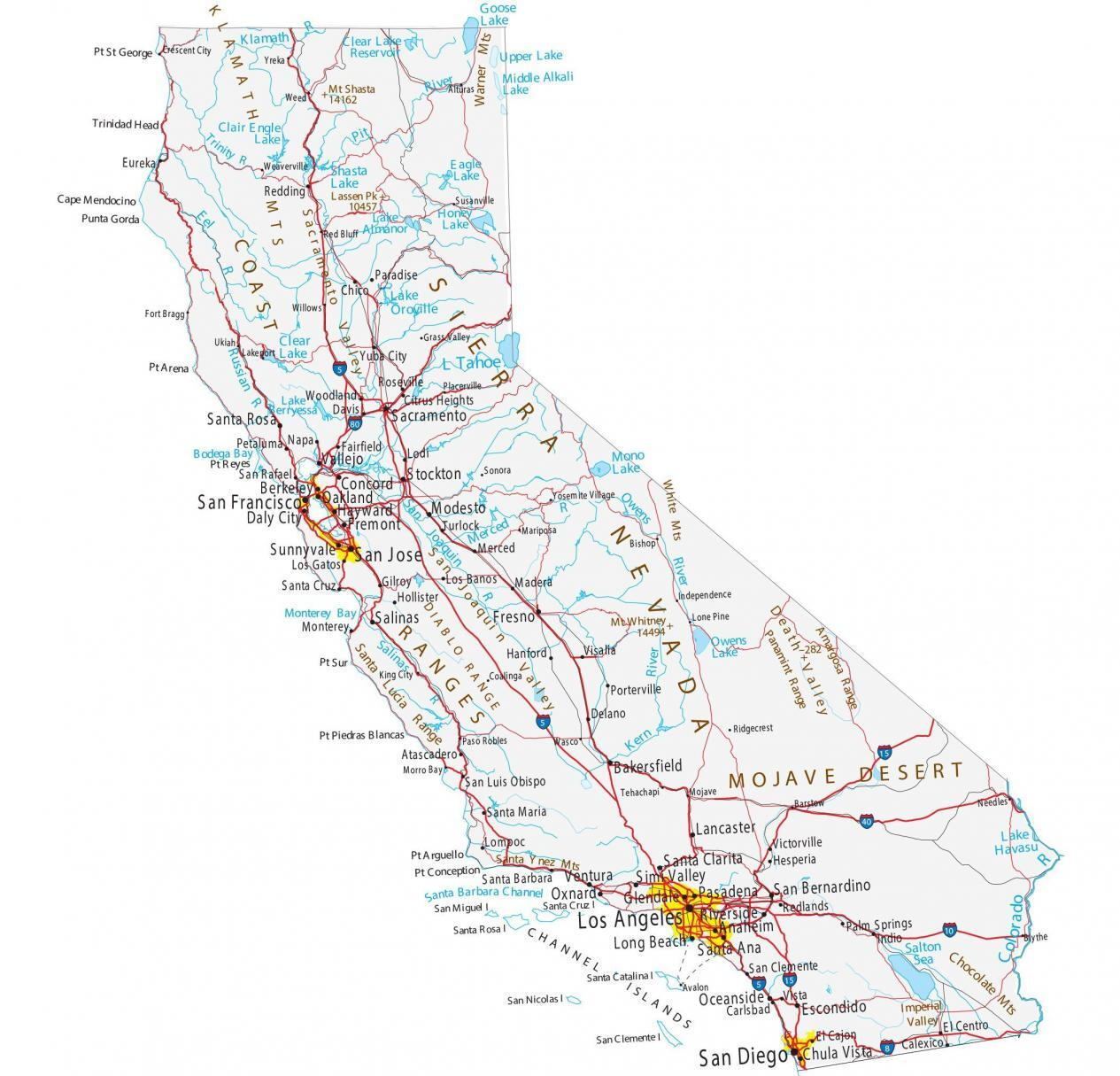
1. California Map with Cities:
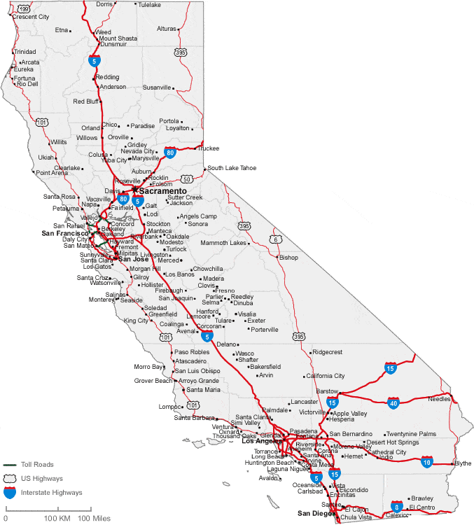
2. California Map with Towns:
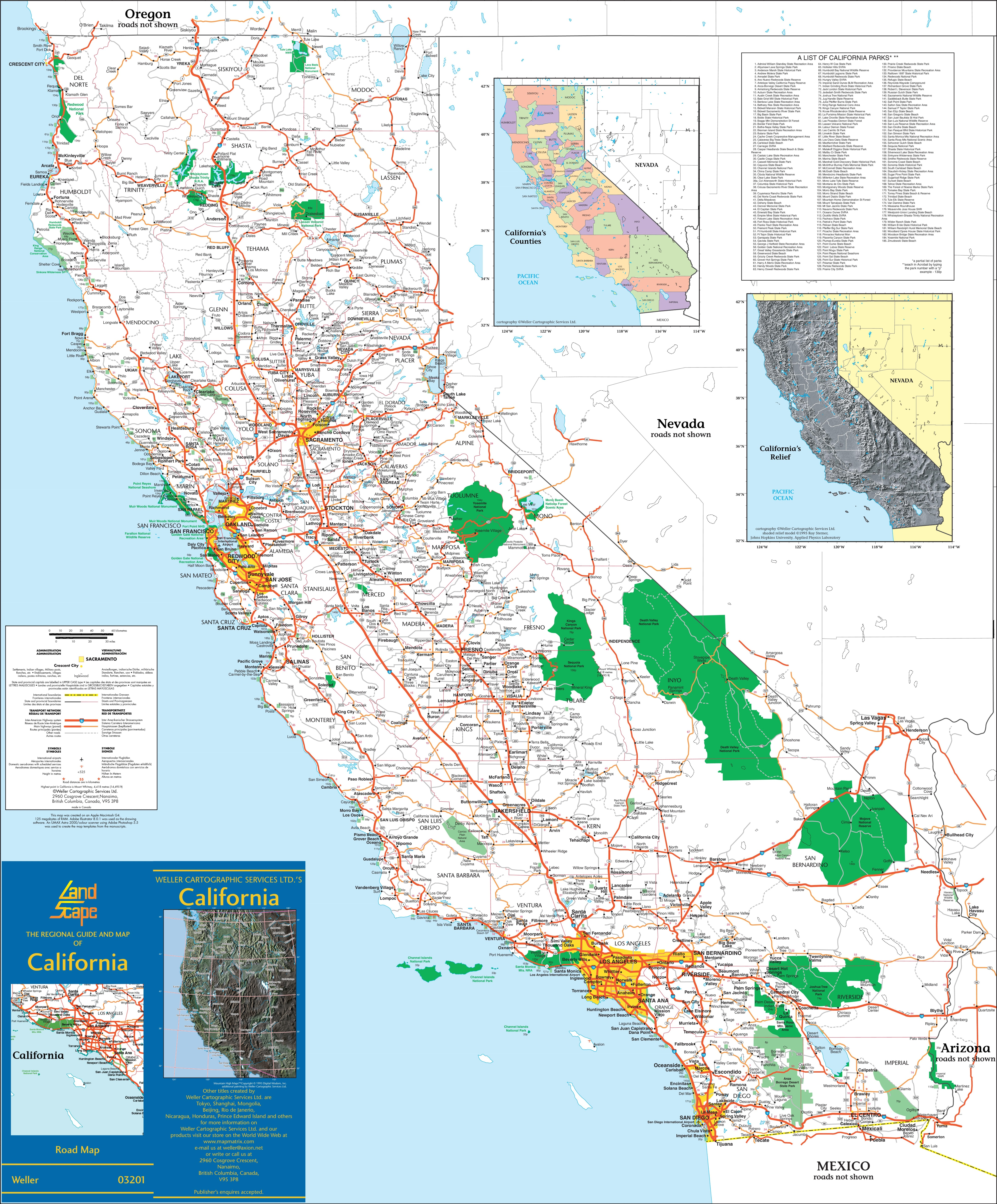
3. Map of California with Major Cities & Towns:
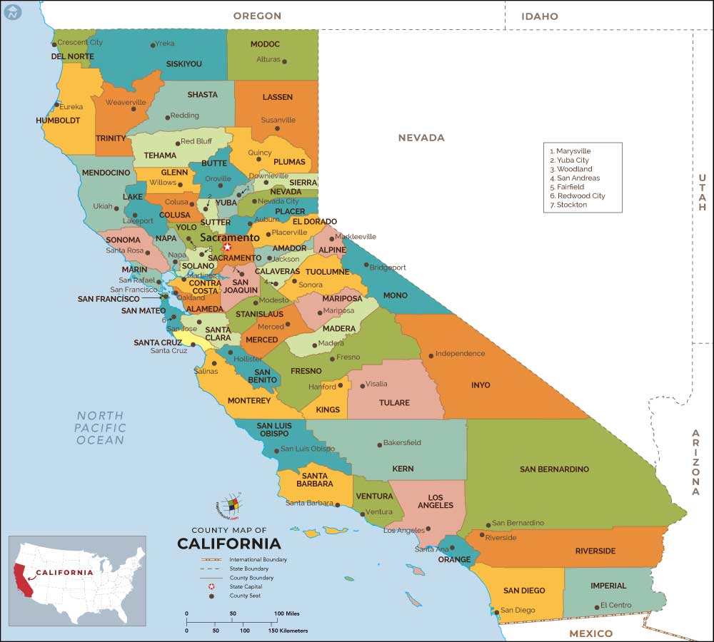
4. CA County Map:
5. CA Map:
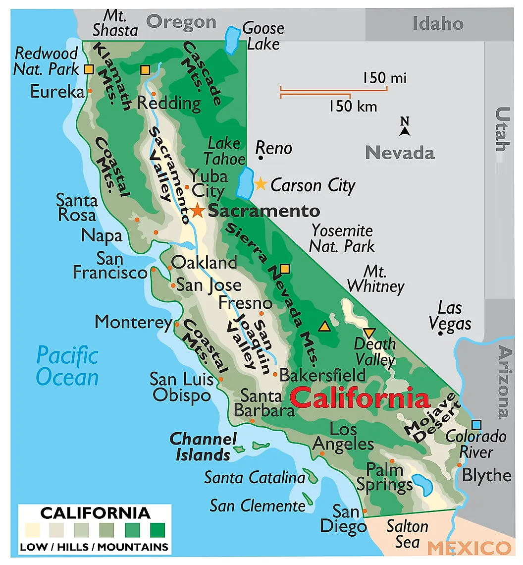
Above, we have added five types of different maps related to the cities and towns of California state. Here, we are also giving some information about each map, so read the information and get any map on your device these maps are available for free.
The first map is related to the Cities of California. So, you can easily locate any city in this state with the help of this map. Now, on the second map, you will get to know about the towns of CA, on this map, you will also find the roads and highways of these towns. The third map is the complete map of California towns, villages, and cities with roads and highways. With the help of this map, you can easily navigate from one city to another city in this state. It is also a detailed map of California with all major cities and towns that will also help you during travel and while traveling or roaming in this state all cities, towns, roads, street roads, highways, rivers, lakes, railroads, stations, beaches, parks, national museums, hotels, malls, fuel stations, airports and etc are visible on this map.
If you are looking for some other maps related to California then visit the link that we are providing below.
- California Road Maps
- California River Maps
- California Mountains Ranges Maps
- California Highway Maps
- Printable Maps of California
The fourth map is related to the main County map of California. On this map, you can easily locate any county. The county seat is also visible on this map. The fifth map is related to the main state map of California. This map shows all counties, major cities, towns, and some water bodies also. So, get this map for free if you need a complete state map. So, these were some best printable California town and city maps. You can easily print any map because all maps are of HD quality and available in both PDF and JPG format. And you can download any map for free by clicking on the buttons under the preview image.