Maine (ME) state is located in the New England region of the USA. This state has 16 Counties, managed by the particular county admin. Here on this page, we are adding some information about each county with some printable and interactive county maps. Please scroll down the page and check our collection of County Map of Maine. These maps will help you to learn about the Counties and cities of Maine. And for additional information, you can also check some other Maine maps by clicking this link.
Maine (ME) County Maps Collection:
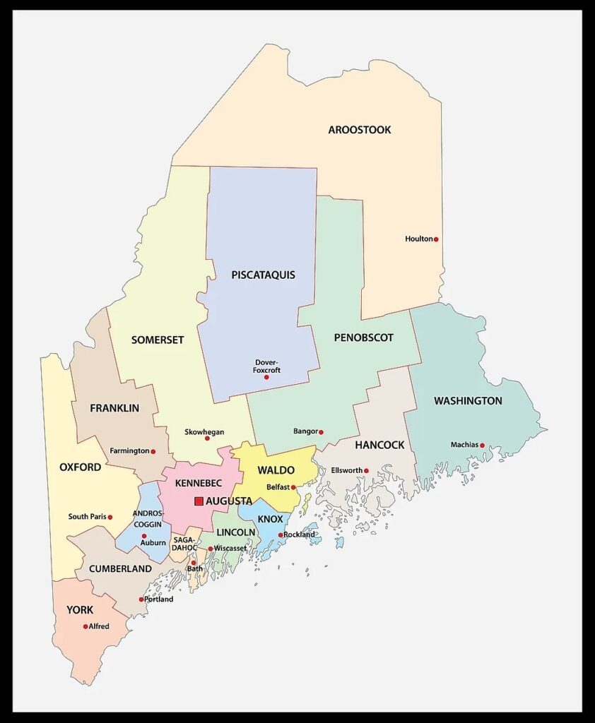
1. County Map of Maine:
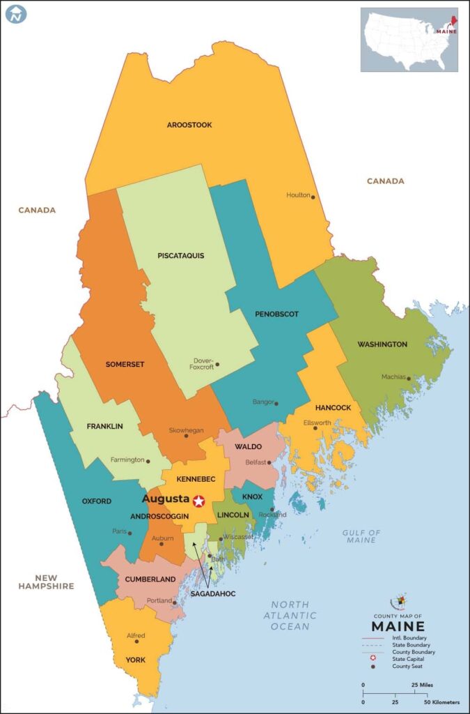
2. Map of Maine Counties and Towns:

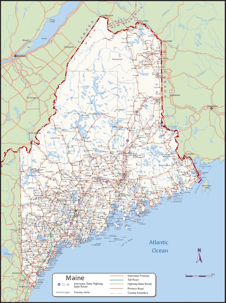
3. Map of Maine County:
4. Maine Map with Cities and Towns:
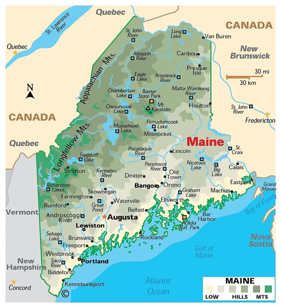
5. The Map of Maine:
Here, we have added five different types of county maps. Each map contains some useful information. For you, we are also adding some more useful information about each county. So, read the description and save any map for any purpose. We are also adding a specific table that shows some information about the counties of Maine, USA.
List of all Counties in the Maine (ME):
With the help of this table, you will learn all about the counties. And for some additional information, you can check the county map of Maine.
| County | Est. | Seat | Population | Area |
| Androscoggin County | 1854 | Auburn | 111139 | 497 sq mi |
| Aroostook County | 1839 | Houlton | 67105 | 6,829 sq mi |
| Cumberland County | 1761 | Portland | 303069 | 1,217 sq mi |
| Franklin County | 1838 | Farmington | 29456 | 1,744 sq mi |
| Hancock County | 1790 | Ellsworth | 55478 | 2,351 sq mi |
| Kennebec County | 1799 | Augusta | 123642 | 951 sq mi |
| Knox County | 1860 | Rockland | 40607 | 1,142 sq mi |
| Lincoln County | 1760 | Wiscasset | 35237 | 700 sq mi |
| Oxford County | 1805 | Paris | 57777 | 2,175 sq mi |
| Penobscot County | 1816 | Bangor | 152199 | 3,556 sq mi |
| Piscataquis County | 1838 | Dover-Foxcroft | 16800 | 4,377 sq mi |
| Sagadahoc County | 1854 | Bath | 36699 | 370 sq mi |
| Somerset County | 1809 | Skowhegan | 50477 | 4,095 sq mi |
| Waldo County | 1827 | Belfast | 39607 | 853 sq mi |
| Washington County | 1790 | Machias | 31095 | 3,255 sq mi |
| York County | 1652 | Alfred | 211972 | 1,271 sq mi |
In the first map, you will see the name of all counties and their location on the Maine Map. Now, the second map is a detailed County map of Maine. This map shows counties along with all major cities and towns. So, you can get this map if you have any work related to the Counties of this state. The third map is also related to its counties, but it shows the county seat with respective counties.
The fourth map is a detailed and large map of Maine’s Cities and Towns. This is a complete and printable map showing all cities, roads, state highways, and their routes. With the help of this map, you can easily move anywhere in any city of this state. The last map is a simple state map of Maine. This map only shows all counties, cities, mountains, hills, rivers and lakes. So, these were some printable maps related to Maine county and towns that we have added above. These high-quality maps are available in PDF and JPG formats. You can easily download any map by clicking on the buttons under the preview image. All these maps are free to download.