Boston is the famous city of Massachusetts State. Boston’s Road and Highway System is managed by the Massachusetts Department of Transportation (MassDOT). This department is responsible for controlling and maintaining all roads, interstate highways, and other major highways. If you want to explore more about the roads and highways of this city, then you must check these Boston Road Map and Highway Map.
Boston Road and Highway Map Collection:
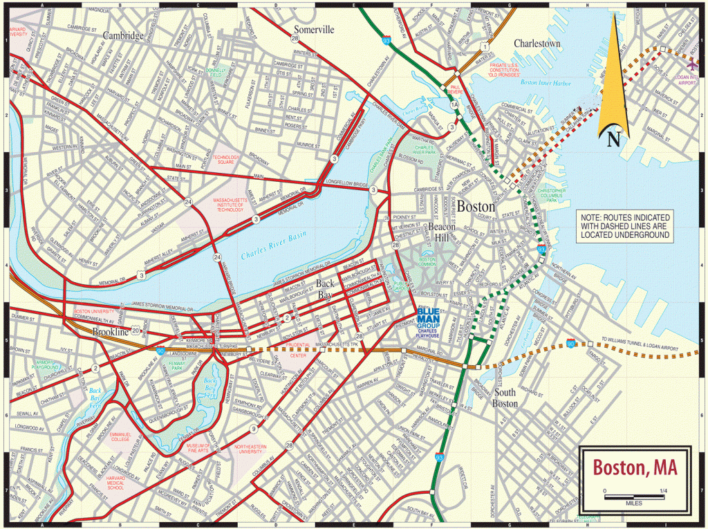
1. Boston Road Map:
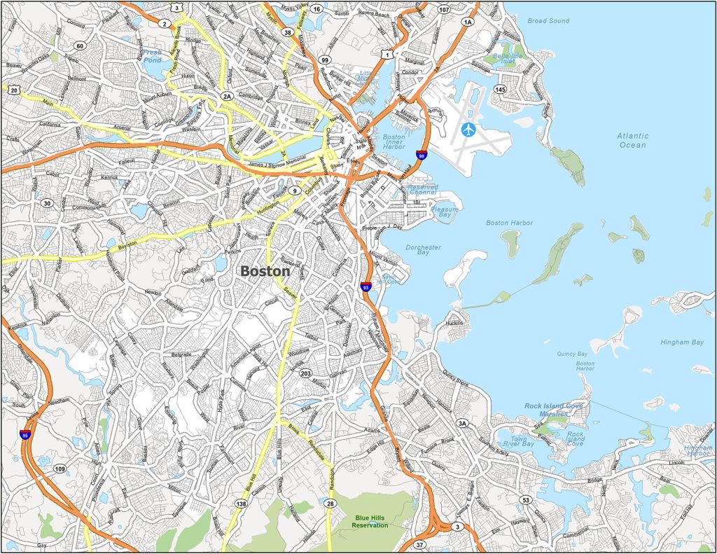
2. Boston Highway Map:
The first map is a Road Map of Boston City. On this map, you will get to know information about the roads of this city. So, with the help of this map, you can navigate anywhere in this city.
The second map, is “Boston Highway Map,” shows information about the highways, interstate highways, and the roads that connect other cities with Boston. In this map, all major highways are marked with orange lines. And, all the highway numbers are mentioned on this map, so you will easily identify and navigate anywhere. There are only two main interstate highways in this city which are I90 and I93
So, these were some best road and highways maps that we have added above. All the maps are available in PDF format as well as in JPG format. You can easily download any map by clicking on the buttons that are under the preview image.